 Filter: Categories of Wisconsin Historical Images
Filter: Subject of Bays
Filter: Subject of human settlements
Filter: Categories of Wisconsin Historical Images
Filter: Subject of Bays
Filter: Subject of human settlements

| Date: | 1795 |
|---|---|
| Description: | Map of Delaware showing counties, cities, roads, swamps, lakes, and rivers. Numerous features within the Delaware Bay include banks, shoals, and oyster be... |

| Date: | 1776 |
|---|---|
| Description: | Map of the Delaware Bay, River, their shoreline, made to aid ships in navigating to Philadelphia. It is oriented with north to the right and shows inlets, ... |
| Date: | 1732 |
|---|---|
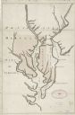
| Description: | Map showing the the Chesapeake and Delaware Bay and surrounding land, including the rivers which drain into the bays. The border of Maryland and Delaware i... |

| Date: | 1780 |
|---|---|
| Description: | Map of Maryland and a portion of the surrounding provinces. It shows the boundary lines and borders, counties, cities, towns, roads, mountains, bays, and r... |

| Date: | 1667 |
|---|---|
| Description: | Map of Virginia depicting the discoveries detailed by John Smith in his exploration of the region. It shows Jamestown, Native American tribes and villages,... |

| Date: | 1671 |
|---|---|
| Description: | Map of Virginia depicting the discoveries detailed by John Smith in his exploration of the region. It shows Jamestown, Native American tribes and villages,... |

| Date: | 1676 |
|---|---|
| Description: | Map of Virginia and Maryland, based on John Smith's 1612 map and Augustine Herman's 1673 seminal map. It shows borders, counties, Native American land, tri... |

| Date: | 1755 |
|---|---|
| Description: | Map of Virginia and parts of Maryland, North Carolina, and New Jersey. It shows borders, boundary lines, some Native American land, counties, cities, towns... |

| Date: | 1776 |
|---|---|
| Description: | Map of Virginia and parts of Maryland and Delaware (written "De La War"). It shows borders, counties, cities, towns, plantations (marked by landowners name... |

| Date: | 1762 |
|---|---|
| Description: | Map of Virginia and parts of Maryland. It shows borders, boundary lines, Native American tribes and land, towns, forts, roads, mountains, waterfalls, bays,... |

| Date: | 1781 |
|---|---|
| Description: | Map of the southern portion of the Chesapeake Bay and surrounding lands. It shows counties, a few cities and towns, forts, roads, islands, topographical fe... |

| Date: | 1763 |
|---|---|
| Description: | Map showing the new British territories of East and West Florida following the Treaty of Paris at the end of the French and Indian War. It shows boundaries... |

| Date: | 1765 |
|---|---|
| Description: | Map showing the new British territories of East and West Florida following the Treaty of Paris at the end of the French and Indian War. It shows boundaries... |

| Date: | 1781 |
|---|---|
| Description: | Map of the Southeastern part of the British Colonies in North America, Gulf Coast and Caribbean. It illustrates the of the Spanish and English fleets, part... |

| Date: | 1781 |
|---|---|
| Description: | Map of the British territory of West Florida, extending from the Mississippi River to the Apalachicola River. It shows the borders, cities, towns, forts, h... |

| Date: | 1761 |
|---|---|
| Description: | Map covering southern Louisiana from Lake Ponchetrain to the Golf of Mexico and from Woods Bay in the west to the islands just east of Bay St. Louis. It sh... |

| Date: | 1759 |
|---|---|
| Description: | Map of New Orleans at the start of the French & Indian War, including two inset maps entitled "The Course of the Mississipi River from Bayagoulas to the Se... |

| Date: | 1769 |
|---|---|
| Description: | Map of New Orleans at the start of the French & Indian War, including two inset maps of the Mississippi River Delta and Fort la Balise. It shows streets, r... |

| Date: | 1932 |
|---|---|
| Description: | This map shows automobile routes across Wisconsin and parts of Illinois, Michigan, Minnesota and Iowa. The Mississippi River, Lake Michigan, Lake Superior,... |

| Date: | 1933 |
|---|---|
| Description: | This road map shows automobile routes across Wisconsin as well as portions of Illinois, Minnesota, Iowa and Michigan. Lakes Michigan, Superior and Winnebag... |
If you didn't find the material you searched for, our Library Reference Staff can help.
Call our reference desk at 608-264-6535 or email us at: