Map or Atlas
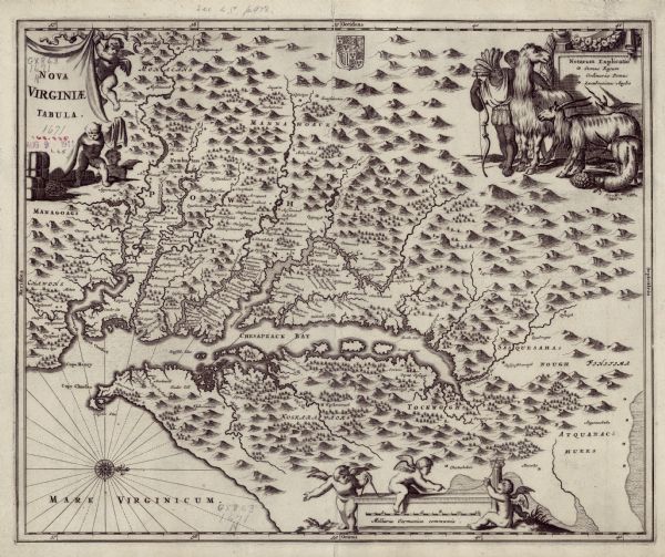
Nova Virginiae Tabula

| Map of Virginia depicting the discoveries detailed by John Smith in his exploration of the region. It shows Jamestown, Native American tribes and villages, mountains, forests, and rivers, with north oriented towards the right. Small Maltese crosses mark the limits of Smith's personal exploration, beyond these crosses Smith relied on Native American accounts. A small British coat of arms appears near the top of the map. Putti hold up the title cartouche in the upper left corner, and more putti perform the work of cartographers and surveyors along the scale at the bottom of the map. A key sits in the upper right, decorated with a scene of Native Americans herding llamas and long horned goats. |
| Image ID: | 124698 |
|---|---|
| Creation Date: | circa 1671 |
| Creator Name: | Ogilby, John |
| City: | |
| County: | |
| State: | Virginia |
| Collection Name: | Map Collection |
| Genre: | Map or Atlas |
| Original Format Type: | prints, fine-art |
| Original Format Number: | H GX863 1671 N |
| Original Dimensions: | 29 x 36 cm, on sheet 47 x 57 cm |
| Based on Blaeu's derivative of John Smith's 1612 map of Virginia, the most important map of Virginia in the seventeenth century. Sources are unclear whether John Ogilby, Arnoldus Montanus, or Jacob van Meurs (or a combination of the three) first contributed to this state of the map. It appears in Arnoldus Montanus's De Nieuwe en Onbekende Weereld, and John Ogilby's America: Being an Accurate Description of the Nevv VVorld, both published or granted copyright in 1670. For an earlier state of the map see image ID: 124697 |
| This image is issued by the Wisconsin Historical Society. Use of the image requires written permission from the staff of the Collections Division. It may not be sold or redistributed, copied or distributed as a photograph, electronic file, or any other media. The image should not be significantly altered through conventional or electronic means. Images altered beyond standard cropping and resizing require further negotiation with a staff member. The user is responsible for all issues of copyright. Please Credit: Wisconsin Historical Society. |
| Location: | Wisconsin Historical Society Archives, 4th Floor, Madison, Wisconsin |
|---|
