 Filter: Categories of Wisconsin Historical Images
Filter: Subject of Maps
Filter: Year of 1700-1799
Filter: Categories of Wisconsin Historical Images
Filter: Subject of Maps
Filter: Year of 1700-1799

| Date: | 1758 |
|---|---|
| Description: | Map showing lakes, rivers, cities, Native American land, and the boundaries of French and English claims in America and Canada north of New York. A title c... |

| Date: | 1766 |
|---|---|
| Description: | Map representing the northern Pacific Ocean along with north eastern Asia and western North America. The interior of Asia contains very detailed engravings... |

| Date: | 1755 |
|---|---|
| Description: | Map of North America east of the Mississippi River showing cities, settlements, Native American land, mountains, lakes, rivers, and the boundaries between ... |

| Date: | 1770 |
|---|---|
| Description: | Map of North America from the Great Lakes to the northern portion of South America. It shows cities, Native American land, mountains, swamps, lakes, rivers... |

| Date: | 1722 |
|---|---|
| Description: | Map of North America including mountains, rivers, lakes, regions, and a few of the most important cities. A highly unusual map with interesting inaccuracie... |

| Date: | 1762 |
|---|---|
| Description: | Map including the land and islands surrounding the Gulf of Mexico. The regions and islands are labeled, as are a few rivers and cities. This map was engrav... |

| Date: | 1740 |
|---|---|
| Description: | Map including the regions and cities of the northern half of North America. Native American land, rivers, lakes, mountains are labeled. Mountains, marshes,... |

| Date: | 1763 |
|---|---|
| Description: | Map of America and part of Canada including the borders of European claims after the French and Indian War. Cities, forts, Native American lands, rivers, l... |

| Date: | 1766 |
|---|---|
| Description: | Map of the north western hemisphere using sinusoidal projection to show the curvature of the earth. It labels regions, cities, Native American land, island... |

| Date: | 1772 |
|---|---|
| Description: | Map of the north west portion of America and Canada, as well as a small section of eastern Russia. Lakes, rivers, Native American land and the occasional ... |

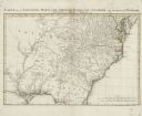
| Date: | 1776 |
|---|---|
| Description: | Map showing the English claims in America at the outbreak of the Revolutionary War. Lotter labels each of the thirteen colonies (both in the map and in the... |
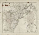
| Date: | 1775 |
|---|---|
| Description: | Map showing the American colonies on the eve of the Revolutionary War. Cities, boundaries, regions, forts, Native American lands, mountains, lakes, and riv... |

| Date: | 1776 |
|---|---|
| Description: | Map of the American colonies and land east of the Mississippi River. Prominent cities, forts, Native American land, mountains, rivers and lakes are all sho... |

| Date: | 1776 |
|---|---|
| Description: | Map of North America east of Mexico showing important cities, the colonies, regions, Native American land, mountains, lakes, and rivers. A series of lakes,... |

| Date: | 1700 |
|---|---|
| Description: | Map of the British colonies in North America at the beginning of the eighteenth century. It includes five inset maps of Nova Scotia, Jamaica, Bermuda, Barb... |

| Date: | 1752 |
|---|---|
| Description: | Map of the the coast line of Louisiana, focusing on the Mississippi, the Arkansas, the Red, the Osage, and the Missouri River. An inset map along the righ... |

| Date: | 1767 |
|---|---|
| Description: | Map of the north east coast of America, showing colonial borders, cities, Native American land, lakes, rivers, and a few hills and mountains. Illustrated t... |

| Date: | 1755 |
|---|---|
| Description: | Map of colonial America, showing the lands north of South Carolina and west of the Mississippi River. An inset map of the Carolinas and Georgia sits in the... |
| Date: | 1758 |
|---|---|
| Description: | Regional map of south eastern America, based largely on D'Anville's map of North America in 1755. It shows the borders, regions, cities and towns, Native A... |

| Date: | 1765 |
|---|---|
| Description: | Detailed map composed for the London Magazine of the Mississippi River Valley at the conclusion of the French and Indian War. The British colonies themselv... |
If you didn't find the material you searched for, our Library Reference Staff can help.
Call our reference desk at 608-264-6535 or email us at: