
| Date: | 1884 |
|---|---|
| Description: | Panorama bird's-eye view of the town of Ashland, on Lake Superior, and the Apostle Islands. |
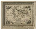
| Date: | 1720 |
|---|---|
| Description: | Double hemispherical world map showing routes of Tasman, Magellan, Mendana, etc. Relief shown pictorially. Title in oak wreath cartouche. Map between four ... |

| Date: | 1798 |
|---|---|
| Description: | Engraved and hand-colored map of Egypt. Map title appears on bottom left as a carving in stone next ... |
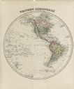
| Date: | 1878 |
|---|---|
| Description: | This lithograph shows Greenland, North America, Central America, South America, Polynesia, Australia, the Pacific Ocean, the Atlantic Ocean, the Arctic Oce... |
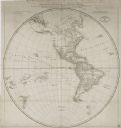
| Date: | 1786 |
|---|---|
| Description: | This map is an updated version of d'Anville's 1761 map of the western hemisphere. He included more details to the north west coast of North America, partic... |

| Date: | 1786 |
|---|---|
| Description: | One half of a four sheet nautical chart, showing the coastlines of the north-west hemisphere. The interior lands are left bare, even of basic features such... |

| Date: | 1776 |
|---|---|
| Description: | This was one of the first maps available for the general British populace featuring America during the Revolutionary War. It includes forts, cities, topogr... |
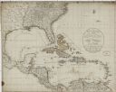
| Date: | 1782 |
|---|---|
| Description: | Map of the West Indies and south eastern North America, remarkably detailed, showing cities, mountains, rivers, lakes, mines, plantations, forts, banks, an... |

| Date: | 1788 |
|---|---|
| Description: | This map shows the north western coast of North America, including the southern coast of what will be Alaska and parts of the Aleutian Islands. It includes... |

| Date: | 1780 |
|---|---|
| Description: | This map shows the townships, parishes, cities, towns, plantations, lakes, rivers, swamps, and roads near the coast of South Carolina and Georgia. Emphasis... |

| Date: | 1769 |
|---|---|
| Description: | Double hemispherical map showing the continents, islands, countries, and a few major cities of the world. The routes of a few explorers are depicted and la... |

| Date: | 1627 |
|---|---|
| Description: | Map of North and South America showing settlements, rivers, lakes, mountains, islands and regions of the western hemisphere. It includes an inset map of Gr... |

| Date: | 1630 |
|---|---|
| Description: | One of the few maps by Dutch cartographer Willem Blaeu depicting the Americas, this map shows regions, settlements, islands, mountains, forests, rivers, an... |

| Date: | 1675 |
|---|---|
| Description: | This atlas shows the western hemisphere, with a small portion of Spain and Africa. Several place names are labeled, such as the Plymouth colony, settlement... |

| Date: | 1690 |
|---|---|
| Description: | A mysterious mixture of mythology, ancient geography, and late 17th century knowledge of the American coastline. This map shows North and South America, bu... |

| Date: | 1676 |
|---|---|
| Description: | Detailed map of North and South America. Cities, towns, forests, and mountains are shown pictorially. Duval labels regions, islands, cities, lakes, and Nat... |

| Date: | 1679 |
|---|---|
| Description: | Decorative and detailed map of the eastern half of North America. Regions, cities, colonies, Native America land, rivers, lakes and some nautical features ... |
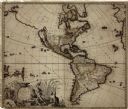
| Date: | 1685 |
|---|---|
| Description: | A detailed map of the western hemisphere showing cities, settlements, Native American land, rivers, lakes, mountains, the Great Lakes, and California as an... |

| Date: | 1700 |
|---|---|
| Description: | Map of the western hemisphere showing settelments, coastal features, islands, rivers, lakes, and pictoral representations of forests and mountains. The Gre... |
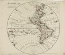
| Date: | 1724 |
|---|---|
| Description: | Map showing the mountains, rivers, lakes, settlements, islands, and regions of North and South America. Characteristic of de L'Isle, this map is highly det... |
If you didn't find the material you searched for, our Library Reference Staff can help.
Call our reference desk at 608-264-6535 or email us at: