Map or Atlas
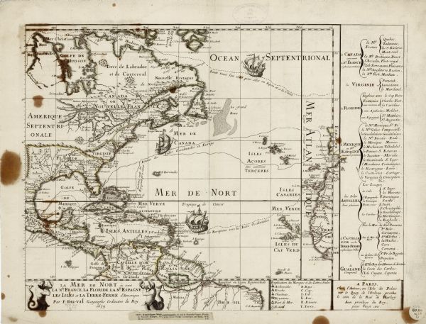
La Mer de Nort où Sont la Nle. France, la Floride, la Nle. Espagne, les Isles et la Terre-Ferme d'Amerique.

| Decorative and detailed map of the eastern half of North America. Regions, cities, colonies, Native America land, rivers, lakes and some nautical features are all labeled. Mountains, forests, and a few important cities are shown pictorially, with a key near the bottom right explaining the latter. Duval includes a list of regional city names along the right edge. Three major ship routs spread across the Atlantic, each adorned with an illustration of a ship. Two depict the route to and from Europe and the West Indies. The third shows the mythical, sought for North West Passage to Japan and China. Two mermen blowing sea shells border the title cartouche in the bottom left corner. |
| Image ID: | 123674 |
|---|---|
| Creation Date: | 1679 |
| Creator Name: | Duval, Pierre |
| City: | |
| County: | |
| State: | |
| Collection Name: | Map Collection |
| Genre: | Map or Atlas |
| Original Format Type: | |
| Original Format Number: | |
| Original Dimensions: |
| This image is issued by the Wisconsin Historical Society. Use of the image requires written permission from the staff of the Collections Division. It may not be sold or redistributed, copied or distributed as a photograph, electronic file, or any other media. The image should not be significantly altered through conventional or electronic means. Images altered beyond standard cropping and resizing require further negotiation with a staff member. The user is responsible for all issues of copyright. Please Credit: Wisconsin Historical Society. |
| Location: | Wisconsin Historical Society Archives, 4th Floor, Madison, Wisconsin |
|---|
