 Filter: Categories of Wisconsin Historical Images
Filter: Subject of War
Filter: Subject of land
Filter: Categories of Wisconsin Historical Images
Filter: Subject of War
Filter: Subject of land

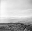
| Date: | 12 26 1943 |
|---|---|
| Description: | Elevated view looking down towards deck of an American cruiser leaving the base heading for the bombardment of Cape Gloucester, New Britain, New Guinea (pr... |

| Date: | 12 26 1943 |
|---|---|
| Description: | Elevated view, perhaps from an American Cruiser, of warships leaving the base heading for the bombardment of Cape Gloucester, New Britain, New Guinea (pres... |

| Date: | 12 26 1943 |
|---|---|
| Description: | Seaman 2nd Class Jerry Burg (left) of Milwaukee, Wisconsin, and Seaman 2nd Class Harold Dawson of Toledo, Ohio, man the plane spotting station on an Americ... |
| Date: | 08 31 1944 |
|---|---|
| Description: | Smoke rising from Cezembre Island, just north of Saint-Malo on the north coast of France. The island, which took a tremendous shelling, can barely be seen ... |

| Date: | 05 17 1980 |
|---|---|
| Description: | Poster in support of the People's War in Peru, which began in 1980. The war was instigated by a Maoist political group within Peru known as the Shining Pat... |

| Date: | 1740 |
|---|---|
| Description: | Engraved and hand-colored map of the Iberian peninsula as a theater of war during the War of the Spanish Succession (1701-1714). The map is dedicated to Ki... |

| Date: | 05 01 1899 |
|---|---|
| Description: | Map showing the Schuylkill River with roads, ferries, and points of interest from Valley Forge to Philadelphia, Pennsylvania as it appeared during the Revo... |

| Date: | 1758 |
|---|---|
| Description: | This detailed map of north eastern America shows the boundaries, cities, mountains, rivers, lakes, Native American land and towns, and roads from east of t... |

| Date: | 1755 |
|---|---|
| Description: | Map of colonial America, showing the lands north of South Carolina and west of the Mississippi River. An inset map of the Carolinas and Georgia sits in the... |

| Date: | 1777 |
|---|---|
| Description: | Map of Colonial America east of Lake Michigan showing regions, cities, forts, Native American land, mountains, lakes, and rivers. Crossed swords and small ... |

| Date: | 1795 |
|---|---|
| Description: | Map of the United States east of the Mississippi River. It features roads, cities, towns, early settlements, Native American land, forts, mountains, rivers... |

| Date: | 1760 |
|---|---|
| Description: | Map showing upstate New York, Lake Ontario, and the St. Lawrence River during the last, decisive battle of the French and Indian War. The main map shows a ... |

| Date: | 1780 |
|---|---|
| Description: | Detailed topographical and political map of the area from Lake Champlain to Albany and the Hudson River. Relief is shown through hachures. The map shows ci... |

| Date: | 10 1776 |
|---|---|
| Description: | Broadside map showing the British invasion of New York city in August and September of 1776. The map shows important cities, forts, roads, hills, mountains... |

| Date: | 1781 |
|---|---|
| Description: | Map of the southern portion of the Chesapeake Bay and surrounding lands. It shows counties, a few cities and towns, forts, roads, islands, topographical fe... |
If you didn't find the material you searched for, our Library Reference Staff can help.
Call our reference desk at 608-264-6535 or email us at: