 Filter: Categories of Wisconsin Historical Images
Filter: Subject of Trees
Filter: Subject of trees
Filter: Subject of coasts
Filter: Categories of Wisconsin Historical Images
Filter: Subject of Trees
Filter: Subject of trees
Filter: Subject of coasts
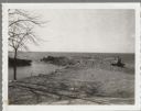
| Date: | 1920 |
|---|---|
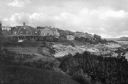
| Description: | View along top of cliff toward cottages along a rocky coast. A large building is in the distance on the right. |
| Date: | |
|---|---|
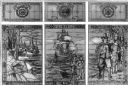
| Description: | View of a stained glass window erected in 1920 in honor of the women of Plymouth Plantation. On the center panel, a ship is in the bay while a man and wom... |

| Date: | |
|---|---|
| Description: | People walk along the Casino Walk promenade between a row of buildings and a beach. Beside the beach is a covered sitting area set with folding chairs. |
| Date: | |
|---|---|
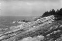
| Description: | View of the rocky coast of Maine as seen from a hillside. The rooftop of a dwelling is visible above a pine forest at right. |

| Date: | |
|---|---|
| Description: | View along shoreline toward a lighthouse and homes standing on Rocky Point. There are several boats anchored at the shore and in the water. |

| Date: | |
|---|---|
| Description: | Elevated view of Bermuda shoreline. Several dwellings stand on top of the island and people swim in the ocean on the beaches below. |

| Date: | 1990 |
|---|---|
| Description: | Color photo of an International school bus driven along a coastal road. In the foreground is a split-rail fence and lawn. The photograph was probably taken... |
| Date: | 1902 |
|---|---|
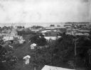
| Description: | Elevated view of the city of Port Limon, Costa Rica with the Caribbean Sea in the background. Trees grow amongst the many commercial and residential buildi... |

| Date: | |
|---|---|
| Description: | View looking down dune towards a man wearing a helmet driving a Scout. Trees and plants are on top of the dunes. The Scout has a windshield and roll bars i... |
| Date: | 04 16 1963 |
|---|---|
| Description: | Chaudoir Dock in Brussels. The shoreline is on the left and has rocks along its edge. In the background is Lake Michigan. |

| Date: | |
|---|---|
| Description: | Aerial view of harbors and bridge. Farm fields are on either side of the bridge. The city of Sturgeon Bay is in the distance. There are docks along the sho... |

| Date: | 1780 |
|---|---|
| Description: | This map shows the townships, parishes, cities, towns, plantations, lakes, rivers, swamps, and roads near the coast of South Carolina and Georgia. Emphasis... |

| Date: | 1755 |
|---|---|
| Description: | Map of the northeastern portion of America and Canada, east of the Hudson River and south from Labrador. It names regions, colonies, cities, numerous forts... |

| Date: | 1759 |
|---|---|
| Description: | Map of north eastern Canada and parts of New England, showing settlements, cities, portages, Native American land, mountains, lakes, and rivers. The unusua... |

| Date: | 1783 |
|---|---|
| Description: | Map of eastern Canada and part of America, with an inset map of the Great Lakes region in the lower left corner. It shows boundaries, cities, settlements, ... |

| Date: | 1776 |
|---|---|
| Description: | Map showing New England, Nova Scotia, and Newfoundland, based on the seminal work of D' Anville, as well as the works of Belllin and de Vaugondy. It shows ... |

| Date: | 1700 |
|---|---|
| Description: | Map of the British colonies in North America at the beginning of the eighteenth century. It includes five inset maps of Nova Scotia, Jamaica, Bermuda, Barb... |

| Date: | 1795 |
|---|---|
| Description: | Map of Connecticut showing counties, townships, cities, roads, islands, swamps, hills, mountains, lakes, rivers, reefs, and numerous other geographical and... |

| Date: | 1667 |
|---|---|
| Description: | Map of Virginia depicting the discoveries detailed by John Smith in his exploration of the region. It shows Jamestown, Native American tribes and villages,... |

| Date: | 1671 |
|---|---|
| Description: | Map of Virginia depicting the discoveries detailed by John Smith in his exploration of the region. It shows Jamestown, Native American tribes and villages,... |
If you didn't find the material you searched for, our Library Reference Staff can help.
Call our reference desk at 608-264-6535 or email us at: