 Filter: Categories of Wisconsin Historical Images
Filter: Subject of Periodicals
Filter: Subject of maps
Filter: Categories of Wisconsin Historical Images
Filter: Subject of Periodicals
Filter: Subject of maps
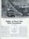
| Date: | 03 1932 |
|---|---|
| Description: | Page from International Trail magazine featuring an article about the use of International trucks for the construction of the Hoover Dam. The title ... |

| Date: | 04 14 1964 |
|---|---|
| Description: | An informal portrait of Morris Rubin sitting at his desk, decked with a glass ashtray, pack of cigarette and matchbook, rotary-dial telephone and papers. S... |

| Date: | 1780 |
|---|---|
| Description: | This map portrays North and South America at a very unusual angle, with north oriented towards the upper right corner. Colonies, Native American land, a fe... |

| Date: | 1758 |
|---|---|
| Description: | Map showing lakes, rivers, cities, Native American land, and the boundaries of French and English claims in America and Canada north of New York. A title c... |

| Date: | 1762 |
|---|---|
| Description: | Map including the land and islands surrounding the Gulf of Mexico. The regions and islands are labeled, as are a few rivers and cities. This map was engrav... |

| Date: | 1763 |
|---|---|
| Description: | Map of America and part of Canada including the borders of European claims after the French and Indian War. Cities, forts, Native American lands, rivers, l... |

| Date: | 1776 |
|---|---|
| Description: | Map of the American colonies and land east of the Mississippi River. Prominent cities, forts, Native American land, mountains, rivers and lakes are all sho... |

| Date: | 1765 |
|---|---|
| Description: | Detailed map composed for the London Magazine of the Mississippi River Valley at the conclusion of the French and Indian War. The British colonies themselv... |

| Date: | 1755 |
|---|---|
| Description: | Map of New England, with three inset maps of Fort Oswego, Fort du Quesne, and Fort Frederick. It shows colonies, a few cities, forts (marked as French or E... |

| Date: | 1775 |
|---|---|
| Description: | Map of Boston and surrounding regions, from Massachusetts Bay to the Connecticut River, and including part of southern New Hampshire. It shows the colonies... |

| Date: | 03 25 1955 |
|---|---|
| Description: | Morris Rubin, editor of The Progressive, sitting at his desk decked with a glass ashtray with cigarette, matchbook, and papers. In 1940, Rubin (b.19... |
If you didn't find the material you searched for, our Library Reference Staff can help.
Call our reference desk at 608-264-6535 or email us at: