 Filter: Categories of Wisconsin Historical Images
Filter: Subject of Islands
Filter: Subject of revolution, 1775-1783
Filter: Categories of Wisconsin Historical Images
Filter: Subject of Islands
Filter: Subject of revolution, 1775-1783
| Date: | |
|---|---|
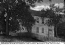
| Description: | The Mother Chick Tavern, where Nathan Hale, widely considered America's first spy during the American Revolutionary War, stopped the night before his captu... |

| Date: | 05 01 1899 |
|---|---|
| Description: | Map showing the Schuylkill River with roads, ferries, and points of interest from Valley Forge to Philadelphia, Pennsylvania as it appeared during the Revo... |

| Date: | 1776 |
|---|---|
| Description: | This was one of the first maps available for the general British populace featuring America during the Revolutionary War. It includes forts, cities, topogr... |

| Date: | 1783 |
|---|---|
| Description: | This map is hand-colored and shows the boundaries of British, Spanish, and the newly recognized American claims, as well as the fishing rights granted to F... |

| Date: | 1795 |
|---|---|
| Description: | Detailed map of New York, showing counties, cities, mines, mills, roads, swamps, mountains, lakes and rivers. The map also shows Native American towns and ... |

| Date: | 10 1776 |
|---|---|
| Description: | Broadside map showing the British invasion of New York city in August and September of 1776. The map shows important cities, forts, roads, hills, mountains... |

| Date: | 02 1777 |
|---|---|
| Description: | Map depicting the campaigns of October and November 1776, in Manhattan, Westchester, and part of New Jersey, published only a few months after the conclusi... |

| Date: | 03 1777 |
|---|---|
| Description: | Map showing the British and Hessian attack on Fort Washington in November of 1776. The movements and fortifications of the British and Hessian troops appea... |

| Date: | 11 1781 |
|---|---|
| Description: | Map of New York, Staten Island, and Long Island, showing the placements of forts, and the movement of troops in 1776. The map also includes towns, cities, ... |

| Date: | 1781 |
|---|---|
| Description: | Map of the southern portion of the Chesapeake Bay and surrounding lands. It shows counties, a few cities and towns, forts, roads, islands, topographical fe... |

| Date: | 1781 |
|---|---|
| Description: | Map of the British territory of West Florida, extending from the Mississippi River to the Apalachicola River. It shows the borders, cities, towns, forts, h... |
If you didn't find the material you searched for, our Library Reference Staff can help.
Call our reference desk at 608-264-6535 or email us at: