
| Date: | 1855 |
|---|---|
| Description: | Map reads "Our Country" which is accompanied by a sailor with a flag to the left and workers rejoicing under the Constitution and Laws to the right. Across... |
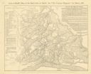
| Date: | 1866 |
|---|---|
| Description: | This detailed map shows the positions of the armies of the Ohio and Tennessee, Confederate lines, headquarters, "regimental camps at the date of the battle... |
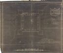
| Date: | 1816 |
|---|---|
| Description: | This is a photostat copy of a manuscript map in the National Archives showing a plan of Fort Howard and a view of its north side. Originally surveyed by Wi... |
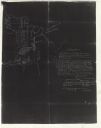
| Date: | 1900 |
|---|---|
| Description: | This photostat of a manuscript map originally drawn in 1829 shows landownership, buildings, including Fort Howard and U.S. sawmill, swamps, public barns an... |
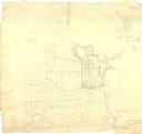
| Date: | 1862 |
|---|---|
| Description: | This map shows landownership on a military reserve, private claims, buildings (including Fort Howard and U.S. sawmill), swamps, public barns and fields, an... |

| Date: | 03 1777 |
|---|---|
| Description: | Map showing the British and Hessian attack on Fort Washington in November of 1776. The movements and fortifications of the British and Hessian troops appea... |

| Date: | 1776 |
|---|---|
| Description: | Fairly detailed map of New York City and parts of Long Island. It shows streets, roads, wharves, ferries, ship yards, Fort George and the battery, public b... |
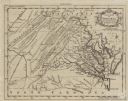
| Date: | 1762 |
|---|---|
| Description: | Map of Virginia and parts of Maryland. It shows borders, boundary lines, Native American tribes and land, towns, forts, roads, mountains, waterfalls, bays,... |

| Date: | 1760 |
|---|---|
| Description: | Map showing the towns, mountains, valleys, corn fields, and rivers of a portion of the Cherokee Nation. A few annotations on the map explain the land and r... |
If you didn't find the material you searched for, our Library Reference Staff can help.
Call our reference desk at 608-264-6535 or email us at: