 Filter: Categories of Wisconsin Historical Images
Filter: GENRE of Map or Atlas
Filter: Community of Milwaukee
Filter: Categories of Wisconsin Historical Images
Filter: GENRE of Map or Atlas
Filter: Community of Milwaukee

| Date: | 06 1837 |
|---|---|
| Description: | Pen-and-ink on paper. Shows riverside property west of the Milwaukee River. Inscribed by several early Milwaukee settlers, including Henry W. Cleveland, Cy... |

| Date: | 1854 |
|---|---|
| Description: | Reproduction printed on glossy, cloth-backed paper. Right side includes "References," or points of interest that correspond to numbers on the map. Running ... |

| Date: | 1855 |
|---|---|
| Description: | Pen-and-ink on paper. Includes certifications signed by surveyor and by "John T. Perkins, by his attorney I.A. Lapham." Inscribed and signed certification ... |

| Date: | 1857 |
|---|---|
| Description: | Caption reads: "THE LOTS embraced in the proposed Addition, are situated in the Fourth Ward of the City of Milwaukee, about twenty minutes walk from Spring... |
| Date: | 06 1858 |
|---|---|
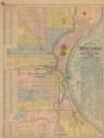
| Description: | This map shows additions and subdivisions to Milwaukee, city wards, roads, railroads, and selected buildings. This map was engraved to accompany the city d... |

| Date: | 1858 |
|---|---|
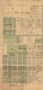
| Description: | Map of Martineau's Addition in the first ward of Milwaukee as well as buildings and location of adjacent additions with landowners names. |

| Date: | 1861 |
|---|---|
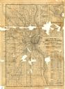
| Description: | Map with labelled block and lot numbers, owners of large property parcels, city wards, railroads, and streets. Population from 1835 to 1860 listed below ti... |

| Date: | 1863 |
|---|---|
| Description: | Includes index to public buildings, churches, schools. Inset: Glidden & Lockwood’s addition. Gives names of some property owners. |

| Date: | 1869 |
|---|---|
| Description: | This map was engraved from original drawings and surveys taken by Louis Lipman. Includes Milwaukee street directory on the left hand side. Bottom right cor... |

| Date: | 05 1958 |
|---|---|
| Description: | Photocopy of a map created by the City of Milwaukee Master Plan Program City Planning Division in May of 1958 representing 1870 "THE CENTRAL AREA OF THE CI... |

| Date: | 1877 |
|---|---|
| Description: | Two maps on one page, removed from an atlas. The first map shows Wisconsin and the upper peninsula of Michigan counties and townships while the second map ... |

| Date: | 1880 |
|---|---|
| Description: | Map created from original drawing and surveys taken by Silas Chapman. Bottom right corner features a reference key. There is a street guide on the left sid... |
| Date: | 1886 |
|---|---|
| Description: | The map reads: "Compiled under the direction of the J.V. DUPRE ABSTRACT CO. from Dupre’s 1/4 Sectn’l Atlas of Milwaukee, by G. Steinhagen, C.E." The map co... |
| Date: | 1886 |
|---|---|
| Description: | Two maps on one page. The first page is a map of Milwaukee County with insets "Plan of Pewaukee, Waukesha Co.," "Plan of Oconomowoc, Waukesha Co.," "Plan o... |

| Date: | 1888 |
|---|---|
| Description: | Map of Milwaukee "Compiled under the direction of the J.V. DUPRE ABSTRACT CO., from Dupre’s 1/4-Sectn’l Atlas of Milwaukee, by G. Steinhagen, C.E." Contain... |

| Date: | 1889 |
|---|---|
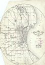
| Description: | Bird’s-eye-view map. Published in the Milwaukee Sentinel: Wednesday morning, August 28, 1889 for the 23rd National Encampments of the GAR, August 27... |
| Date: | 1890 |
|---|---|
| Description: | Map of Merrill Estate property for sale and sold. Map reads: "Merrill Estate property (colored) lots marked X are sold for terms & prices inquire of S.H. C... |

| Date: | 1891 |
|---|---|
| Description: | This maps has an index of depots, hotels, prominent institutions and buildings, churches, and places of amusement. The map was removed from an unidentified... |

| Date: | 1891 |
|---|---|
| Description: | Map of a proposed subdivision. Map reads: "United States Investment Association SUBDIVISION No. 1 In S.W. 1/4 Sec. 33, Town 8, Range 22 East. Is situated a... |

| Date: | 1896 |
|---|---|
| Description: | Map highlighting parks and other points of interest in Milwaukee. |
If you didn't find the material you searched for, our Library Reference Staff can help.
Call our reference desk at 608-264-6535 or email us at: