 Filter: Categories of Wisconsin Historical Images
Filter: Subject of War
Filter: Subject of arts
Filter: Subject of land
Filter: Categories of Wisconsin Historical Images
Filter: Subject of War
Filter: Subject of arts
Filter: Subject of land

| Date: | 1889 |
|---|---|
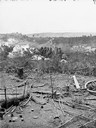
| Description: | Stereograph from the Chicago Panorama of the Battle of Gettysburg Representing Pickett's Charge at 4 P.M., July 3rd, 1863: 69th Pennsylvania in Flank Attac... |
| Date: | 1889 |
|---|---|
| Description: | Stereograph from the Panorama of the Battle of Missionary Ridge, Colonel Randall L. Gibson and 13th Georgia Regiment, painted in 1885. It was painted by Eu... |

| Date: | 1889 |
|---|---|
| Description: | Stereograph from the Panorama of the Battle of Missionary Ridge, Capture of the Gun, "Lady Breckenridge," painted in 1885. It was painted by Eugen Bracht's... |

| Date: | 1889 |
|---|---|
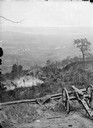
| Description: | Stereograph from the Panorama of the Battle of Missionary Ridge, Confederate "Star Fort," General Sheridan in Foreground, painted in 1885. It was painted b... |
| Date: | 1889 |
|---|---|
| Description: | Stereograph from the Panorama of the Battle of Missionary Ridge, Confederate Fortifications, General Sheridan's Horses in Road, painted in 1885. It was pai... |
| Date: | 1889 |
|---|---|
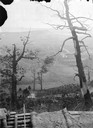
| Description: | Stereograph from the Panorama of the Battle of Missionary Ridge, Historical Sycamore Tree, Orchard Knob in the Distance, painted in 1885. It was painted by... |

| Date: | 1959 |
|---|---|
| Description: | Juan Almeida Bosque, operating chief of the Cuban airforce, and a small group having a picnic in the countryside of Cuba. Three soldiers in fatigues are si... |

| Date: | 1740 |
|---|---|
| Description: | Engraved and hand-colored map of the Iberian peninsula as a theater of war during the War of the Spanish Succession (1701-1714). The map is dedicated to Ki... |

| Date: | 1758 |
|---|---|
| Description: | This detailed map of north eastern America shows the boundaries, cities, mountains, rivers, lakes, Native American land and towns, and roads from east of t... |

| Date: | 1755 |
|---|---|
| Description: | Map of colonial America, showing the lands north of South Carolina and west of the Mississippi River. An inset map of the Carolinas and Georgia sits in the... |

| Date: | 1777 |
|---|---|
| Description: | Map of Colonial America east of Lake Michigan showing regions, cities, forts, Native American land, mountains, lakes, and rivers. Crossed swords and small ... |

| Date: | 1795 |
|---|---|
| Description: | Map of the United States east of the Mississippi River. It features roads, cities, towns, early settlements, Native American land, forts, mountains, rivers... |

| Date: | 1760 |
|---|---|
| Description: | Map showing upstate New York, Lake Ontario, and the St. Lawrence River during the last, decisive battle of the French and Indian War. The main map shows a ... |

| Date: | 1780 |
|---|---|
| Description: | Detailed topographical and political map of the area from Lake Champlain to Albany and the Hudson River. Relief is shown through hachures. The map shows ci... |

| Date: | 10 1776 |
|---|---|
| Description: | Broadside map showing the British invasion of New York city in August and September of 1776. The map shows important cities, forts, roads, hills, mountains... |

| Date: | 1781 |
|---|---|
| Description: | Map of the southern portion of the Chesapeake Bay and surrounding lands. It shows counties, a few cities and towns, forts, roads, islands, topographical fe... |
If you didn't find the material you searched for, our Library Reference Staff can help.
Call our reference desk at 608-264-6535 or email us at: