| Date: | 1784 |
|---|---|
| Description: | Plate 41. Scene from Cook's Third Expedition, 1776-1779, while in Alaska. |

| Date: | 1784 |
|---|---|
| Description: | Plate 57. Scene from Cook's Third Expedition, 1776-1779, while in Alaska. |

| Date: | 1785 |
|---|---|
| Description: | Map of part of North America engraved and hand-colored (the light brown design is a superposition of the map and cartouche derived from the oxidation of th... |

| Date: | 1783 |
|---|---|
| Description: | This map is hand-colored and shows the boundaries of British, Spanish, and the newly recognized American claims, as well as the fishing rights granted to F... |

| Date: | 1784 |
|---|---|
| Description: | Map showing fifty thousand acres of land in what will later become Kentucky, broken up into parcels labeled 1 through 50. No features are labeled, but the ... |

| Date: | 1780 |
|---|---|
| Description: | This map shows the townships, parishes, cities, towns, plantations, lakes, rivers, swamps, and roads near the coast of South Carolina and Georgia. Emphasis... |

| Date: | 1783 |
|---|---|
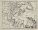
| Description: | Map of eastern Canada and part of America, with an inset map of the Great Lakes region in the lower left corner. It shows boundaries, cities, settlements, ... |

| Date: | 1780 |
|---|---|
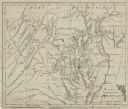
| Description: | Map of Maryland and a portion of the surrounding provinces. It shows the boundary lines and borders, counties, cities, towns, roads, mountains, bays, and r... |
If you didn't find the material you searched for, our Library Reference Staff can help.
Call our reference desk at 608-264-6535 or email us at: