| Date: | 1883 |
|---|---|
| Description: | Engraving of a woman carrying a bundle of clothing and standing with her back to the sea. Behind her other women are in the process of doing wash in the wa... |

| Date: | 1655 |
|---|---|
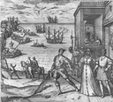
| Description: | Christopher Columbus begins his first expedition, 1492. |

| Date: | |
|---|---|
| Description: | I had to know the point to which the path was tracked and when the definition would cease to be my own |

| Date: | 1720 |
|---|---|
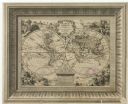
| Description: | Double hemispherical world map showing routes of Tasman, Magellan, Mendana, etc. Relief shown pictorially. Title in oak wreath cartouche. Map between four ... |

| Date: | 1696 |
|---|---|
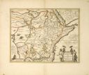
| Description: | Engraved and hand-colored map of Ethiopia, from Blaeu's General Atlas. Map title is framed by a man and a woman, both wearing head turbans, who are standin... |

| Date: | 1953 |
|---|---|
| Description: | Front and back of one-page menu from the Scandia Restaurant, with a whimsical cartoon map rendering by Hakon Mielche of the Scandinavian countries and the ... |

| Date: | 1703 |
|---|---|
| Description: | Map of the Golf of Mexico and surrounding countries from the Great Lakes down to the northern most parts of South America. L'Isle labels cities, towns, and... |

| Date: | 1746 |
|---|---|
| Description: | Map of North America from the southern portion of James Bay to Florida. It shows the colonies, cities, Native American land, and topological and geographic... |

| Date: | 1627 |
|---|---|
| Description: | Map of North and South America showing settlements, rivers, lakes, mountains, islands and regions of the western hemisphere. It includes an inset map of Gr... |

| Date: | 1630 |
|---|---|
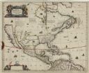
| Description: | One of the few maps by Dutch cartographer Willem Blaeu depicting the Americas, this map shows regions, settlements, islands, mountains, forests, rivers, an... |

| Date: | 1636 |
|---|---|
| Description: | Map of North America, divided into regions, and showing some rivers, lakes, settlements, cities, mountains, and Native American land. Of the Great Lakes on... |

| Date: | 1684 |
|---|---|
| Description: | Map of North America showing some colonies, cities, rivers, lakes, and Native American land. Ship routes spread across both oceans, including one decorated... |

| Date: | 1733 |
|---|---|
| Description: | This map of North America shows settlements, rivers, lakes, Native American land, trade winds, and numerous topographical features such as forests and moun... |

| Date: | 1770 |
|---|---|
| Description: | Map of North America from the Great Lakes to the northern portion of South America. It shows cities, Native American land, mountains, swamps, lakes, rivers... |

| Date: | 1920 |
|---|---|
| Description: | Stone lanterns on the shore near a leaning pine tree frame a view of the Great Torii on Japan's Inland Sea. Two Japanese women in traditional kimonos are s... |

| Date: | 07 02 1920 |
|---|---|
| Description: | Alfred Holt is standing on the beach, carrying several boxes under his arm. To his right is his father W.A. Holt. A group of eight women are sitting on the... |
If you didn't find the material you searched for, our Library Reference Staff can help.
Call our reference desk at 608-264-6535 or email us at: