Map or Atlas
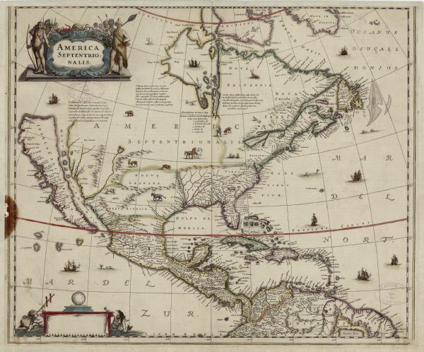
America Septentrionalis

| Map of North America, divided into regions, and showing some rivers, lakes, settlements, cities, mountains, and Native American land. Of the Great Lakes only Lake Ontario (here called Lac des Iroquois) is depicted. Illustrations of various animals, such as pigs, deer, horses, bears, and dogs dot the interior, while ships and sea monsters appear throughout the oceans. A few descriptive blocks of text sit in otherwise blank areas of Canada. Hondius shows California as an island, and this map particularly influenced the geographical myth of the Island of California. A blank cartouche sits in the bottom left adorned by mermaids. This lack of inscription marks this as the first state of this map. The title cartouche is hand-painted, and Native American men and women are holding bows and spears. |
| Image ID: | 123707 |
|---|---|
| Creation Date: | 1636 |
| Creator Name: | Hondius, Henrik |
| City: | |
| County: | |
| State: | |
| Collection Name: | Map Collection |
| Genre: | Map or Atlas |
| Original Format Type: | prints, fine-art |
| Original Format Number: | H GX81 1635 J |
| Original Dimensions: | 45 x 53 cm., on sheet 48 x 58 cm |
| This image is issued by the Wisconsin Historical Society. Use of the image requires written permission from the staff of the Collections Division. It may not be sold or redistributed, copied or distributed as a photograph, electronic file, or any other media. The image should not be significantly altered through conventional or electronic means. Images altered beyond standard cropping and resizing require further negotiation with a staff member. The user is responsible for all issues of copyright. Please Credit: Wisconsin Historical Society. |
| Location: | Wisconsin Historical Society Archives, 4th Floor, Madison, Wisconsin |
|---|
