 Filter: Categories of Wisconsin Historical Images
Filter: Subject of Indian reservations
Filter: Type of Map or Atlas
Filter: Year of 1800-1899
Filter: Categories of Wisconsin Historical Images
Filter: Subject of Indian reservations
Filter: Type of Map or Atlas
Filter: Year of 1800-1899

| Date: | 1886 |
|---|---|
| Description: | This map shows U.S. land offices, completed railroads, railroad land grant limits, lakes, rivers, and Indian reservations. Communities, lakes, and rivers a... |
| Date: | 1882 |
|---|---|
| Description: | Map showing Indian Reservations in the United States. |

| Date: | 1877 |
|---|---|
| Description: | Map showing location of Indian reservations in the United States and population figures. |

| Date: | 1886 |
|---|---|
| Description: | Wisconsin map showing land offices, railroads completed, railroad land grants and Indian reservations. |

| Date: | 1896 |
|---|---|
| Description: | This hand-colored map shows counties, county seats, cities, towns, proposed and completed railroads, and U.S. Land Offices. Also included in the map are th... |

| Date: | 10 21 1855 |
|---|---|
| Description: | Map of the Wisconsin and the Minnesota Territory showing the status of township surveys in Wisconsin and southeastern Minnesota. The Wisconsin reservation... |

| Date: | 1857 |
|---|---|
| Description: | A map of the state of Wisconsin and the southeastern portion of the Territory of Minnesota, showing the Wisconsin reservations of the Oneida, Menominee, St... |

| Date: | 1860 |
|---|---|
| Description: | A map of Wisconsin showing the railroads, rivers, counties, cities, villages, and named towns in the state, as well as the township grid for the portion of... |

| Date: | 1860 |
|---|---|
| Description: | A survey map of Wisconsin, southeastern Minnesota, and northern Iowa, showing the status of surveys, rivers, and lakes. The map also shows the locations of... |

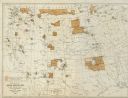
| Date: | 1880 |
|---|---|
| Description: | A hand-colored map of the Chippewa, Price, Taylor and the northern part of Clark counties, which shows the locations of farmhouses, schoolhouses, churches,... |

| Date: | 1847 |
|---|---|
| Description: | A hand-colored map that shows the area south and east of the Wisconsin and Fox Rivers, as well as a few landmarks just north of that area. The township gri... |

| Date: | 1855 |
|---|---|
| Description: | This map shows the entire state and part of the Upper Peninsula of Michigan. It depicts creeks, rivers, lakes, railroads completed, railroads in progress, ... |

| Date: | 1855 |
|---|---|
| Description: | This Wisconsin map depicts counties, creeks, rivers, lakes, railroads completed, railroads in progress, common roads and the Menomonee Reservation. |

| Date: | 1855 |
|---|---|
| Description: | This map depicts counties, creeks, rivers, lakes, railroads completed, railroads in progress, common roads and the Menomonee Reservation. |

| Date: | 1855 |
|---|---|
| Description: | This map shows the township survey grid and identifies counties, named towns, rivers, lakes, railroads, plank roads, mines, and the Menomonee Reservation. ... |

| Date: | 1856 |
|---|---|
| Description: | This map with an ornamental border shows the township survey grid and identifies counties, named towns, cities and villages, rivers, lakes, railroads, road... |

| Date: | 1856 |
|---|---|
| Description: | This map of shows the township survey grid and identifies counties, named towns, cities and villages, rivers, lakes, railroads, roads, and the Menomonee an... |

| Date: | 1857 |
|---|---|
| Description: | This map depicts the township survey grid and identifies counties, named towns, cities and villages, rivers, lakes, railroads, roads, and the Menomonee and... |

| Date: | 1858 |
|---|---|
| Description: | This map of the entire state of Wisconsin depicts the township survey grid and identifies counties, named towns, cities and villages, rivers, lakes, railro... |

| Date: | 1859 |
|---|---|
| Description: | This map of the entire state of Wisconsin depicts the township survey grid and identifies counties, named towns, cities and villages, rivers, lakes, railro... |
If you didn't find the material you searched for, our Library Reference Staff can help.
Call our reference desk at 608-264-6535 or email us at: