
| Date: | 1769 |
|---|---|
| Description: | Double hemispherical map showing the continents, islands, countries, and a few major cities of the world. The routes of a few explorers are depicted and la... |
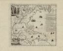
| Date: | 1713 |
|---|---|
| Description: | Map showing the regions explored by Robert de La Salle between 1681 and 1686, as well as the route La Salle, and later Henri Joutel, took, moving north fro... |
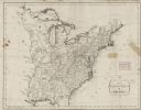
| Date: | 1794 |
|---|---|
| Description: | Map of the United States east of the Mississippi River. It shows borders, treaty lines, forts, cities, towns, Native American land, mountains, swamps, lake... |

| Date: | 1795 |
|---|---|
| Description: | Map of Maine, showing a few cities, harbors, hills, mountains, lakes, and rivers. A road runs from Pownalboro south to Portsmouth harbor, and the boundary ... |
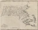
| Date: | 1795 |
|---|---|
| Description: | Map of Massachusetts showing counties, cities, roads, islands (including Nantucket and Martha's Vineyard), mountains, hills, lakes, and rivers. Two small e... |

| Date: | 04 1777 |
|---|---|
| Description: | Map showing the area from Newtown, Pennsylvania to Kingston, New Jersey, with routes and battles of British (red) and American forces (blue). The map inclu... |
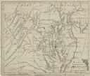
| Date: | 1780 |
|---|---|
| Description: | Map of Maryland and a portion of the surrounding provinces. It shows the boundary lines and borders, counties, cities, towns, roads, mountains, bays, and r... |
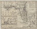
| Date: | 1763 |
|---|---|
| Description: | Map showing the new British territories of East and West Florida following the Treaty of Paris at the end of the French and Indian War. It shows boundaries... |
If you didn't find the material you searched for, our Library Reference Staff can help.
Call our reference desk at 608-264-6535 or email us at: