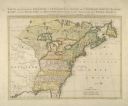
| Date: | 1755 |
|---|---|
| Description: | Color map of North American territories owned by the English and by the French. Scale: about 115 milles d'Angleterre to 1 inch. French title is "Carte des ... |

| Date: | 1783 |
|---|---|
| Description: | This map is hand-colored and shows the boundaries of British, Spanish, and the newly recognized American claims, as well as the fishing rights granted to F... |

| Date: | 1784 |
|---|---|
| Description: | Map showing fifty thousand acres of land in what will later become Kentucky, broken up into parcels labeled 1 through 50. No features are labeled, but the ... |

| Leader and warrior of the Sauk Indians |
|---|
| Biography of Black Hawk |

| Use the 1829 speech by Little Elk, Ho-Chunk orator, to learn more about Ho-Chunk views on Euro-American cultures |

| Supplemental materials for the 4th-grade textbook, 'Wisconsin: Our State Our Story' |
|---|
| Chapter 4 description and supplemental materials for the 4th-grade textbook, 'Wisconsin: Our State Our Story' |

| Read about Black history in Wisconsin. There are many links to original documents, pictures, eyewitness accounts, and other primary sources. |
If you didn't find the material you searched for, our Library Reference Staff can help.
Call our reference desk at 608-264-6535 or email us at: