Filter: Community of Bayfield
Filter: Year of 1800-1899
Filter: Community of Bayfield
Filter: Year of 1800-1899

| Date: | 1886 |
|---|---|
| Description: | Bird's-eye view of Bayfield, county seat of Bayfield County. On the lower left side is an inset for Bayfield and the Apostle Islands. |
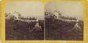
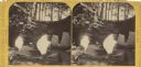
| Date: | 1876 |
|---|---|
| Description: | Stereograph view of Lake Superior scenery and downtown area. |
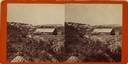
| Date: | 1885 |
|---|---|
| Description: | Stereograph of a sailboat in Excursion Cave, on Hemlock Island of the Apostle Islands. A man can be seen sitting in the boat. |

| Date: | 1858 |
|---|---|
| Description: | Front cover of a guide book describing Bayfield and an account of a pleasure tour to Lake Superior. The title is surrounded by a decorative border with flo... |
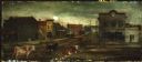
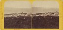
| Date: | 1885 |
|---|---|
| Description: | Main Street in Bayfield in 1870 with four cows standing in the street. |

| Date: | 1871 |
|---|---|
| Description: | Asaph Whittlesey arrived in Ashland in 1854, one of the earliest of the settlers who hoped the area would grow and make their fortunes. He drew this map of... |

| Beyond Beer and Brats |
|---|
| Explore the history of Labor Day celebrations in Wisconsin. |
| Promotions on Paper, 1850s-1975 |
|---|
| Custom-designed letterheads were a universal way of proclaiming who you were. Historical letterheads are prime examples of early branding. |

| Date: | 1856 |
|---|---|
| Description: | This map of Bayfield shows a plat of the town, roads, and part of Lake Superior. Relief is shown by hachures. The right margin of the map includes illustra... |

| Date: | 1892 |
|---|---|
| Description: | This map of Bayfield shows roads, lots, and township boundaries. The map was originally published on one sheet but is now separated into front and back. On... |

| Date: | 1856 |
|---|---|
| Description: | This map shows land ownership by name, a plat of Bayfield, local streets, part of Lake Superior, part of Madeline Island, and part of Bass Island. La Point... |
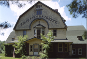
| Community: | Bayfield |
|---|---|
| County: | Bayfield |
| Historic Name: | BAYFIELD FISH HATCHERY |
| Reference Number: | 1068 |
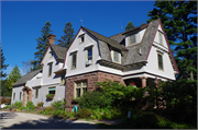
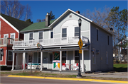
| Community: | Bayfield |
|---|---|
| County: | Bayfield |
| Historic Name: | PILLAR HOUSE (SO NAMED BY ARCHITECT) |
| Reference Number: | 1069 |

| Community: | Bayfield |
|---|---|
| County: | Bayfield |
| Historic Name: | St. Anthony Church |
| Reference Number: | 1070 |
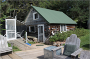
| Community: | Bayfield |
|---|---|
| County: | Bayfield |
| Historic Name: | Shaw-Hill Farm - Log Cabin |
| Reference Number: | 1100 |
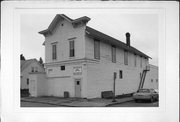
| Community: | Bayfield |
|---|---|
| County: | Bayfield |
| Historic Name: | ODDFELLOWS HALL (TATE BLDG) (OLD IC) |
| Reference Number: | 1133 |
| Community: | Bayfield |
|---|---|
| County: | Bayfield |
| Historic Name: | Henry Wachsmuth House |
| Reference Number: | 1137 |
If you didn't find the material you searched for, our Library Reference Staff can help.
Call our reference desk at 608-264-6535 or email us at: