 Filter: Categories of Wisconsin Historical Images
Filter: Subject of political science
Filter: Year of 1700-1799
Filter: Year of 1780-1789
Filter: Categories of Wisconsin Historical Images
Filter: Subject of political science
Filter: Year of 1700-1799
Filter: Year of 1780-1789

| Date: | 1786 |
|---|---|
| Description: | Portrait engraving of Thomas Jefferson, from the painting by M. Brown. |
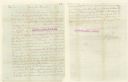
| Date: | 1783 |
|---|---|
| Description: | Letter from Thomas Jefferson to George Rogers Clark suggesting a transcontinental expedition. |

| Date: | 09 19 1787 |
|---|---|
| Description: | The first printing of the United States Constitution found in the "Pennsylvania Packet," and "Daily Advertiser." |

| Date: | 09 19 1787 |
|---|---|
| Description: | The first printing of the United States Constitution found in the "Pennsylvania Packet," and "Daily Advertiser." |

| Date: | 1782 |
|---|---|
| Description: | Map of the West Indies and south eastern North America, remarkably detailed, showing cities, mountains, rivers, lakes, mines, plantations, forts, banks, an... |

| Date: | 1783 |
|---|---|
| Description: | This map is hand-colored and shows the boundaries of British, Spanish, and the newly recognized American claims, as well as the fishing rights granted to F... |

| Date: | 1780 |
|---|---|
| Description: | Map of North and South America, showing the boundaries of colonial territories, cities, settlements, rivers, lakes, and Native American land. Particular em... |

| Date: | 1780 |
|---|---|
| Description: | Map of North America east of Mexico showing colonial boundaries, forts, cities, Native American land, mountains, waterfalls, lakes, and rivers. Short notes... |

| Date: | 02 1783 |
|---|---|
| Description: | Map of the United States and one of the first to show the new boundaries created by the Preliminary Treaty signed on January 20, 1783. The former colonies ... |

| Date: | 1783 |
|---|---|
| Description: | Map of the newly formed United States showing borders, regions, Native American land, cities, mountains, lakes, and rivers. It includes a small inset map o... |

| Date: | 1782 |
|---|---|
| Description: | Map of America covering the Rio Grande to the Atlantic Ocean, showing boundaries, the colonies, cities, settlements, Native American lands and villages, m... |

| Date: | 02 04 1783 |
|---|---|
| Description: | One of the first and few maps to attempt to map the new boundaries of the United States and British territories during the preliminary treaty at the end of... |
If you didn't find the material you searched for, our Library Reference Staff can help.
Call our reference desk at 608-264-6535 or email us at: