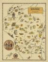
| Date: | |
|---|---|
| Description: | Map reads: "Historic and Scenic Wisconsin — Land of Gathering Waters." In an inset there is a hand-painted depiction of the Wisconsin State Seal. For some ... |
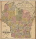
| Date: | 1864 |
|---|---|
| Description: | This map of the entire state of Wisconsin depicts the township survey grid and identifies counties, named towns, cities and villages, rivers, lakes, railro... |
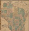
| Date: | 1865 |
|---|---|
| Description: | This map of the entire state of Wisconsin depicts the township survey grid and identifies counties, named towns, cities and villages, rivers, lakes, railro... |
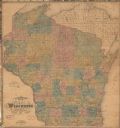
| Date: | 1867 |
|---|---|
| Description: | A hand-colored map of Wisconsin showing the state’s township grid, lakes, rivers, railroads, as well as the locations of towns, counties and the reservatio... |
| Date: | 1871 |
|---|---|
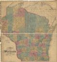
| Description: | This map of Wisconsin and surrounding states depicts the township survey grid and identifies counties, named towns, cities and villages, rivers, lakes, rai... |

| Date: | 1871 |
|---|---|
| Description: | This map of Wisconsin and surrounding states depicts the township survey grid and identifies counties, named towns, cities and villages, rivers, lakes, rai... |
| Date: | 1875 |
|---|---|
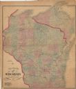
| Description: | This hand-colored map of Wisconsin and the western portion of Michigan's Upper Peninsula depicts the township survey grid and identifies counties, named to... |
| Date: | 1878 |
|---|---|
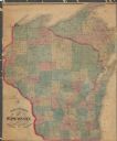
| Description: | A hand-colored, cloth mounted, sectional map of Wisconsin and the western portion of Michigan’s Upper Peninsula, showing the township grid, railroads, town... |
| Date: | 1880 |
|---|---|
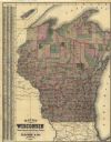
| Description: | A hand-colored, sectional map of Wisconsin showing the township grid, railroads, counties, towns, cities, villages, and the Menomonee, Oneida, Flambeau, an... |

| Date: | 1882 |
|---|---|
| Description: | A hand-colored, sectional map of Wisconsin showing the township grid, completed and proposed railroads, counties, towns, cities, villages. The map also inc... |

| Date: | 1838 |
|---|---|
| Description: | This map is a development plat that shows street names, numbered blocks and lots, and small farm lot owners. Included on the right of the map is a large am... |
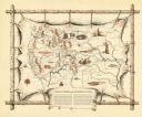
| Date: | 1949 |
|---|---|
| Description: | This pictorial map shows the United States west of the Mississippi, including Indian Tribes, historic trails, forts, trading posts, mountain ranges, lakes ... |

| Date: | 1937 |
|---|---|
| Description: | Pictorial map showing historical events and locations within the state of Wisconsin, as well as waterways and counties. Original caption on the bottom marg... |

| Date: | 1900 |
|---|---|
| Description: | This map shows a line, marked with latitude and longitude coordinates that runs through Prairie du Chien. Only a few features beyond this line are displaye... |
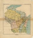
| Date: | 1899 |
|---|---|
| Description: | This map shows color coded and numbered regions of Indian land cessions. Lake Superior and Lake Michigan are labeled and other lakes and rivers are shown. ... |

| Date: | 1899 |
|---|---|
| Description: | This map shows color coded and numbered regions of Indian land cessions. Lake Superior and Lake Michigan are labeled and other lakes and rivers are shown. ... |

| Date: | 1758 |
|---|---|
| Description: | This detailed map of north eastern America shows the boundaries, cities, mountains, rivers, lakes, Native American land and towns, and roads from east of t... |
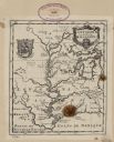
| Date: | 1720 |
|---|---|
| Description: | Map showing the course of the Mississippi River from the Gulf of Mexico up past Lake Superior into Canada. It shows the towns, Native American tribes and l... |
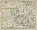
| Date: | 1755 |
|---|---|
| Description: | Map of the Great Lakes region during the French and Indian War. It shows in great detail the territories, borders and boundary lines, Native American tribe... |
If you didn't find the material you searched for, our Library Reference Staff can help.
Call our reference desk at 608-264-6535 or email us at: