| Date: | 1855 |
|---|---|
| Description: | Map reads "Our Country" which is accompanied by a sailor with a flag to the left and workers rejoicing under the Constitution and Laws to the right. Across... |

| Date: | 1968 |
|---|---|
| Description: | Elevated view of a large crowd gathered in front of the Internal Revenue Service Manhattan District Office to protest war taxes. The protesters carry large... |

| Date: | 1962 |
|---|---|
| Description: | Canal in Binh Hung Vietnam with numerous small boats and a crowd of people walking alongside. In the background is a large cross and a number of large that... |

| Date: | 06 1962 |
|---|---|
| Description: | Large funeral for multiple people in Binh Hung, Vietnam. Numerous decoratively painted coffins with cloth coverings are on display in a large open-air, roo... |

| Date: | 1962 |
|---|---|
| Description: | A group of Vietnamese soldiers display a South Vietnamese flag they captured in combat. |

| Date: | |
|---|---|
| Description: | The fife and drum are not so innocent the vulture's eye is on the dance |

| Date: | 05 01 1899 |
|---|---|
| Description: | Map showing the Schuylkill River with roads, ferries, and points of interest from Valley Forge to Philadelphia, Pennsylvania as it appeared during the Revo... |

| Date: | 1758 |
|---|---|
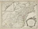
| Description: | This detailed map of north eastern America shows the boundaries, cities, mountains, rivers, lakes, Native American land and towns, and roads from east of t... |

| Date: | 1758 |
|---|---|
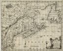
| Description: | Map showing lakes, rivers, cities, Native American land, and the boundaries of French and English claims in America and Canada north of New York. A title c... |

| Date: | 1755 |
|---|---|
| Description: | Map of colonial America, showing the lands north of South Carolina and west of the Mississippi River. An inset map of the Carolinas and Georgia sits in the... |

| Date: | 1777 |
|---|---|
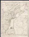
| Description: | Map of Colonial America east of Lake Michigan showing regions, cities, forts, Native American land, mountains, lakes, and rivers. Crossed swords and small ... |

| Date: | 1936 |
|---|---|
| Description: | Poster in English, French, German and Spanish. Includes text in four languages, and images of children and war damage. |
If you didn't find the material you searched for, our Library Reference Staff can help.
Call our reference desk at 608-264-6535 or email us at: