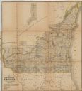
| Date: | 1849 |
|---|---|
| Description: | Published in Germany a year after Wisconsin entered statehood, this map shows prairies, swamps, lakes, mounds, limestone deposits, and lead and copper mine... |

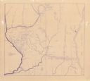
| Date: | 1871 |
|---|---|
| Description: | This map of Wisconsin and surrounding states depicts the township survey grid and identifies counties, named towns, cities and villages, rivers, lakes, rai... |

| Date: | |
|---|---|
| Description: | "Section of New Prairie du Chien Marquette $1,000,000 Suspension Bridge. Total length 3729 feet. Only suspension bridge on the Mississippi River. Open for ... |

| Date: | 1929 |
|---|---|
| Description: | Elevated view from Signal Point of the Mississippi River, railroad and surrounding forest and wetlands. |

| Date: | |
|---|---|
| Description: | A bird's eye view overlooking the Mississippi River, sand bars, the railroad bridge, surrounding forests and wetlands. |

| Date: | 1900 |
|---|---|
| Description: | This map shows the boundary lines between ceded and unceded land in compliance with the Treaty of Prairie du Chen of 1829. It also shows roads, rivers, por... |

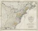
| Date: | 1784 |
|---|---|
| Description: | Detailed and ornate map of the newly formed United States. The borders of the southern states extend to the Mississippi River, though the states are only c... |

| Date: | 1720 |
|---|---|
| Description: | Detailed, ornate, and comprehensive map of America from the east coast to present day Texas. Numerous features appear throughout the map, including Native ... |

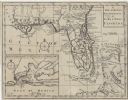
| Date: | 1763 |
|---|---|
| Description: | Map showing the new British territories of East and West Florida following the Treaty of Paris at the end of the French and Indian War. It shows boundaries... |
If you didn't find the material you searched for, our Library Reference Staff can help.
Call our reference desk at 608-264-6535 or email us at: