 Filter: Categories of Wisconsin Historical Images
Filter: Subject of Mississippi River
Filter: Subject of cherokee indians
Filter: Categories of Wisconsin Historical Images
Filter: Subject of Mississippi River
Filter: Subject of cherokee indians
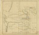
| Date: | 1834 |
|---|---|
| Description: | This map shows the locations of Indian tribes, and lands sold and ceded, as well as roads, forts, and rivers. Lands in the Great Plains are covered, and Ar... |

| Date: | 1760 |
|---|---|
| Description: | Map showing the towns, mountains, valleys, corn fields, and rivers of a portion of the Cherokee Nation. A few annotations on the map explain the land and r... |

| Date: | 1781 |
|---|---|
| Description: | Map of the Southeastern part of the British Colonies in North America, Gulf Coast and Caribbean. It illustrates the of the Spanish and English fleets, part... |
If you didn't find the material you searched for, our Library Reference Staff can help.
Call our reference desk at 608-264-6535 or email us at: