Search the Wisconsin Historical Society's collections

Searching for

Refine by

Results 1-2 of 2

Map or Atlas

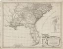
A New and General Map of the Southern Dominions Belonging to the United States of America: Viz North Carolina, South Carolina, and Georgia with the Bordering Indian Countries, and the Spanish Possessions of Louisiana and Florida

Date: 1794
Description: Extremely detailed map of the south-eastern states, south from Virginia and east of the Mississippi River. It shows roads and paths, cities, towns, forts, ...
Map or Atlas

A Map of East and West Florida, Georgia, and Louisiana: With the Islands of Cuba, Bahama, and the Countries Surrounding the Gulf of Mexico, With the Tract of the Spanish Galleons, and of Our Fleets Thro' the Straits of Florida, from the Best Authorities

Date: 1781
Description: Map of the Southeastern part of the British Colonies in North America, Gulf Coast and Caribbean. It illustrates the of the Spanish and English fleets, part...

Have Questions?

If you didn't find the material you searched for, our Library Reference Staff can help.

Call our reference desk at 608-264-6535 or email us at: