 Filter: Categories of Wisconsin Historical Images
Filter: Subject of Marshes
Filter: Subject of roads
Filter: Categories of Wisconsin Historical Images
Filter: Subject of Marshes
Filter: Subject of roads

| Date: | 1972 |
|---|---|
| Description: | This map on 5 sheets features a title page sheet with business directory and shows section numbers, roads, railroads, saw mills, churches, blacksmith shops... |

| Date: | 1839 |
|---|---|
| Description: | This map shows the township and section grid, lakes, rivers, swamps, prairies, roads, and proposed canals in the area of Wisconsin south of Lake Winnebago ... |

| Date: | 1840 |
|---|---|
| Description: | This hand-colored map shows the township and section grid in southeastern Wisconsin, covering the area west to Sugar River and Four Lakes region and north ... |

| Date: | 1856 |
|---|---|
| Description: | This map with an ornamental border shows the township survey grid and identifies counties, named towns, cities and villages, rivers, lakes, railroads, road... |

| Date: | 1856 |
|---|---|
| Description: | This map of shows the township survey grid and identifies counties, named towns, cities and villages, rivers, lakes, railroads, roads, and the Menomonee an... |

| Date: | 1857 |
|---|---|
| Description: | This map depicts the township survey grid and identifies counties, named towns, cities and villages, rivers, lakes, railroads, roads, and the Menomonee and... |

| Date: | 1857 |
|---|---|
| Description: | This map depicts the township survey grid in Wisconsin and northern Michigan and identifies counties, named towns, cities and villages, rivers, lakes, rail... |

| Date: | 1858 |
|---|---|
| Description: | This map of the entire state of Wisconsin depicts the township survey grid and identifies counties, named towns, cities and villages, rivers, lakes, railro... |

| Date: | 1859 |
|---|---|
| Description: | This map of the entire state of Wisconsin depicts the township survey grid and identifies counties, named towns, cities and villages, rivers, lakes, railro... |

| Date: | 1865 |
|---|---|
| Description: | This map of the entire state of Wisconsin depicts the township survey grid and identifies counties, named towns, cities and villages, rivers, lakes, railro... |

| Date: | 1873 |
|---|---|
| Description: | A map that covers parts of Winona and Houston Counties, Minnesota and La Crosse County, Wisconsin, showing the proposed railroad routes, constructed rail l... |

| Date: | |
|---|---|
| Description: | A map of the Wisconsin counties of Lincoln, Oneida, Vilas, parts of Iron, Price & Langlade that shows the township and range grid, sections, villages, rai... |

| Date: | 1916 |
|---|---|
| Description: | This Wisconsin Conservation Commission map from 1916 shows Peninsula State Park in the Town of Gibraltar, Door County, Wisconsin. Depicted are open and pla... |

| Date: | 1916 |
|---|---|
| Description: | This version of a 1916 Wisconsin Conservation Commission map shows Peninsula State Park in the Town of Gibraltar, Door County, Wisconsin. Depicted are open... |

| Date: | 1858 |
|---|---|
| Description: | This 1858 map of Racine County, Wisconsin, shows land ownership and acreages, the township and range grid, towns, cities and villages, roads, railroads, sc... |

| Date: | 1914 |
|---|---|
| Description: | This early 20th century map shows the township and range system, sections, railroads, roads, lakes, wetlands, and streams in the western Sawyer County town... |

| Date: | 1974 |
|---|---|
| Description: | This 1968 map identifies resorts in the Lac du Flambeau Indian Reservation region of Wisconsin, covering parts of Iron, Vilas, Oneida, and Price counties. ... |

| Date: | 1896 |
|---|---|
| Description: | This late 19th-century map of Dodge County, Wisconsin, shows the township and range grid, towns, sections, cities, villages and post offices, some property... |
| Date: | 1908 |
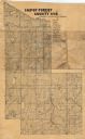
|---|---|
| Description: | Map shows swamps, windfalls, roads and railroads. Status of some land marked (O, S, X) but lacks explanation. |

| Date: | 1975 |
|---|---|
| Description: | This map shows settlers, Indian trails, roads, marshes, and forests as they appeared in 1800-1840. "A bicentennial map of Racine County for the benefit of ... |
If you didn't find the material you searched for, our Library Reference Staff can help.
Call our reference desk at 608-264-6535 or email us at: