 Filter: Categories of Wisconsin Historical Images
Filter: Subject of Land
Filter: County of Dane
Filter: Year of 1800-1899
Filter: Subject of water
Filter: Categories of Wisconsin Historical Images
Filter: Subject of Land
Filter: County of Dane
Filter: Year of 1800-1899
Filter: Subject of water

| Date: | 1893 |
|---|---|
| Description: | Back of painting reads: "Madison in June 1837 after photo taken by E.E. Bailey" and "Peck's cabin by Dengel." The Eben Peck cabin was the first house built... |

| Date: | 06 1837 |
|---|---|
| Description: | Lithograph based on a painting by Mrs. E.E. Bailey showing the Peck cabin, the first house in Madison. In addition to the cabin, the lithograph includes a ... |

| Date: | 1851 |
|---|---|
| Description: | Plat map of the Town of Madison (Township 7N, Range 9E), from Volume 4, Federal Survey Plat Books. |

| Date: | 1873 |
|---|---|
| Description: | Map of the township of Windsor, from the "Atlas of Dane County." |

| Date: | 1861 |
|---|---|
| Description: | Drawn the first year of the Civil War, this colored 1861 map of Dane County shows its towns, cities and lakes. It includes insets of the wards of Madison a... |

| Date: | 1876 |
|---|---|
| Description: | Bird's-eye view of Black Earth. |

| Date: | 1839 |
|---|---|
| Description: | A map of the Wiskonsin [sic] and Neenah or Fox Rivers. |

| Date: | 1897 |
|---|---|
| Description: | A view from the capitol looking west up State Street toward the University of Wisconsin-Madison with the Holy Redeemer Church, Holy Redeemer School, Red Gy... |

| Date: | 1879 |
|---|---|
| Description: | Bird's-eye view of Wisconsin State University, now the University of Wisconsin-Madison. Vignettes include Ladies Hall, South Dormitory, University Hall, As... |

| Date: | 1885 |
|---|---|
| Description: | Bird's-eye map of Madison, State Capital of Wisconsin, County Seat of Dane County, with inset of the Wisconsin State Capitol. |

| Date: | 1852 |
|---|---|
| Description: | Pencil drawing of Madison landscape as seen from University Hill. The main street in the center is State Street, and the building with Greek columns in the... |

| Date: | 1852 |
|---|---|
| Description: | Pencil drawing of view overlooking Madison. The sketch looks down North Hamilton Street from the capitol. Rutted, irregular streets and frame houses mark ... |

| Date: | 1836 |
|---|---|
| Description: | The top map is the "Plat of Madison the Capitol of Wisconsin." The bottom map is the "Map of the Four Lake Country. Taken from the Township Maps in the U.S... |

| Date: | 1875 |
|---|---|
| Description: | Bird's-eye map of Mazomanie. |

| Date: | 1855 |
|---|---|
| Description: | Part of George Harrison's "Map of the City of Madison," showing the development of the isthmus and the small size of the second Capitol (54' x 104') in com... |

| Date: | 1896 |
|---|---|
| Description: | A portion of John B. Heim's map of the Water Works System of Madison showing the size of the third Wisconsin Capitol (228' x 226') in comparison with the C... |
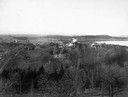
| Date: | 1898 |
|---|---|
| Description: | Elevated view of Observatory Hill, Observatory Hall, the Agriculture Campus and Lake Mendota on the University of Wisconsin-Madison Campus. |
If you didn't find the material you searched for, our Library Reference Staff can help.
Call our reference desk at 608-264-6535 or email us at:


