 Filter: Categories of Wisconsin Historical Images
Filter: Subject of Clothing and dress
Filter: Subject of botany
Filter: Subject of coasts
Filter: Categories of Wisconsin Historical Images
Filter: Subject of Clothing and dress
Filter: Subject of botany
Filter: Subject of coasts
| Date: | |
|---|---|
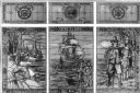
| Description: | View of a stained glass window erected in 1920 in honor of the women of Plymouth Plantation. On the center panel, a ship is in the bay while a man and wom... |
| Date: | |
|---|---|
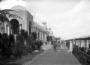
| Description: | People walk along the Casino Walk promenade between a row of buildings and a beach. Beside the beach is a covered sitting area set with folding chairs. |
| Date: | |
|---|---|
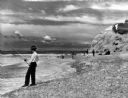
| Description: | View of men surf fishing along a rocky shoreline at Point State Park. |

| Date: | |
|---|---|
| Description: | Elevated view of Bermuda shoreline. Several dwellings stand on top of the island and people swim in the ocean on the beaches below. |

| Date: | |
|---|---|
| Description: | Driver's side view of Scout parked on beach. The Scout has a windshield and roll bars in place, but no doors. A white helmet is sitting on the driver's sea... |

| Date: | |
|---|---|
| Description: | View looking down dune towards a man wearing a helmet driving a Scout. Trees and plants are on top of the dunes. The Scout has a windshield and roll bars i... |

| Date: | 1968 |
|---|---|
| Description: | Three-quarter view from front of passenger side of red International Scout with white Traveltop. Two people are in the front seat. The sides of the Travelt... |

| Date: | 1759 |
|---|---|
| Description: | Map of north eastern Canada and parts of New England, showing settlements, cities, portages, Native American land, mountains, lakes, and rivers. The unusua... |

| Date: | 1667 |
|---|---|
| Description: | Map of Virginia depicting the discoveries detailed by John Smith in his exploration of the region. It shows Jamestown, Native American tribes and villages,... |

| Date: | 1671 |
|---|---|
| Description: | Map of Virginia depicting the discoveries detailed by John Smith in his exploration of the region. It shows Jamestown, Native American tribes and villages,... |
If you didn't find the material you searched for, our Library Reference Staff can help.
Call our reference desk at 608-264-6535 or email us at: