
| Date: | |
|---|---|
| Description: | Map of the district of the Peshtigo fire, approximately 1,280,000 acres, in Wisconsin and Upper Michigan. |
| Date: | 1863 |
|---|---|
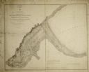
| Description: | Map of the west end of Lake Superior, including Superior, St. Louis, and Allouez Bays. |

| Date: | 1860 |
|---|---|
| Description: | A hand-drawn, ink on cloth map of southeastern Wisconsin that show roads and railroads that connect Chicago to Milwaukee and other towns in the southeaster... |

| Date: | 1860 |
|---|---|
| Description: | This map, traced from John Farmer's 1860 Map of the states of Michigan and Wisconsin, shows the boundary between Michigan's Upper Peninsula and northern Wi... |

| Date: | 1886 |
|---|---|
| Description: | This map, originally published in the 1881 Illustrated historical atlas of Wisconsin, shows the township and range system, sections,towns, cities and villa... |

| Date: | 1930 |
|---|---|
| Description: | This map shows a plat of the town, local streets, railroads, creeks, part of Fox River, and part of the bay of Green Bay. The location of the original fort... |

| Date: | 1924 |
|---|---|
| Description: | This map is pen, pencil, and watercolor on paper and shows land ownership by name, local streets, railroads, and part of Chequamegon Bay. The map includes ... |

| Date: | 1914 |
|---|---|
| Description: | This map has relief shown by hachures and shows local streets, wards, districts, railroads, Fox River, and part of Bay of Green Bay. Wards are shown in dar... |

| Date: | 1891 |
|---|---|
| Description: | This colorful map shows additions, railroads, docks, streets, established dock lines, marshes, and proposed belt line railroad. The map covers west and sou... |

| Date: | 1962 |
|---|---|
| Description: | This map shows streets, points of interest, Lake Winnebago, Millers Bay, South Asylum Bay, Lake Butte des Morts, and the Fox River. The map also includes a... |
| Date: | 1924 |
|---|---|
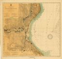
| Description: | This map shows streets, selected buildings, railroads, railway yards, schools, parks, schools, cemeteries, bays, the Milwaukee River, and Lake Michigan. De... |
| Date: | 1915 |
|---|---|
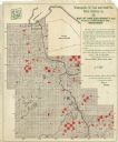
| Description: | This map shows school houses, churches, farms, and railroads. Chequamecon Bay and Bad River Indian Reservation are labeld. The map reads: "All lands shown ... |

| Date: | 1920 |
|---|---|
| Description: | This blue line print map shows land claimed by the state and land claimed by Michigan, including disputed areas between the Branch River and Brule Lake and... |

| Date: | 1920 |
|---|---|
| Description: | This map represents around 1841 and shows Lake Superior, other lakes, rivers, bays, and the border between Michigan and Wisconsin. There are annotations in... |

| Date: | 1936 |
|---|---|
| Description: | This map shows campsites, trails, auto roads, surrounding townships, and points of interest, by including pictorial illustrations. Includes an inserted map... |
| Date: | 1683 |
|---|---|
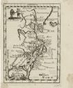
| Description: | Map of the north east coast of North America showing islands, regions, Native American land, bays, and a few European settlements. The Great Lakes appear i... |
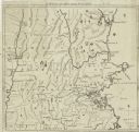
| Date: | 1775 |
|---|---|
| Description: | Map of Boston and surrounding regions, from Massachusetts Bay to the Connecticut River, and including part of southern New Hampshire. It shows the colonies... |
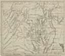
| Date: | 1780 |
|---|---|
| Description: | Map of Maryland and a portion of the surrounding provinces. It shows the boundary lines and borders, counties, cities, towns, roads, mountains, bays, and r... |
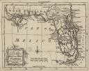
| Date: | 1765 |
|---|---|
| Description: | Map showing the new British territories of East and West Florida following the Treaty of Paris at the end of the French and Indian War. It shows boundaries... |

| Date: | 1761 |
|---|---|
| Description: | Map covering southern Louisiana from Lake Ponchetrain to the Golf of Mexico and from Woods Bay in the west to the islands just east of Bay St. Louis. It sh... |
If you didn't find the material you searched for, our Library Reference Staff can help.
Call our reference desk at 608-264-6535 or email us at: