Map or Atlas
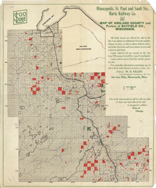
Map of Ashland County and Portion of Bayfield Co., Wisconsin

| This map shows school houses, churches, farms, and railroads. Chequamecon Bay and Bad River Indian Reservation are labeld. The map reads: "All lands shown are offered for sale by the Soo Line subject to withdrawal from the market, change of price, or sale to others without notice, and under the terms and reservations of our usual contracts and deeds. Lands colored red are owned by the Soo Line (Wisconsin Central Ry. Land Grant lands). Lands colored green listed by outside parties for sale. For particular information concerning any of above lands with reference to prices, terms, ect. Address, W.H. Killen, Land and Industrial Commissioner, Soo Line. Soo Line Bldg., Minneapolis, Minn." |
| Image ID: | 115257 |
|---|---|
| Creation Date: | circa 1915 |
| Creator Name: | Unknown |
| City: | |
| County: | Ashland |
| State: | Wisconsin |
| Collection Name: | Map Collection |
| Genre: | Map or Atlas |
| Original Format Type: | prints, photomechanical |
| Original Format Number: | D GX9028 P94 S4 folder 10 (no. 120) |
| Original Dimensions: | 64 x 53 cm., on sheet 67 x 56 cm. |
| Indian reservations |
| Railroads |
| Bays |
| Church buildings |
| Schools |
| Farms |
| Roads |
| Land |
| This image is issued by the Wisconsin Historical Society. Use of the image requires written permission from the staff of the Collections Division. It may not be sold or redistributed, copied or distributed as a photograph, electronic file, or any other media. The image should not be significantly altered through conventional or electronic means. Images altered beyond standard cropping and resizing require further negotiation with a staff member. The user is responsible for all issues of copyright. Please Credit: Wisconsin Historical Society. |
| Location: | Wisconsin Historical Society Archives, 4th Floor, Madison, Wisconsin |
|---|
