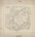
| Date: | 1862 |
|---|---|
| Description: | This map consists of four separate panels. The first illustrates the battlefield at Cedar Mountain on Aug. 9, 1862, where the 3rd Wisconsin Infantry fought... |

| Date: | 1865 |
|---|---|
| Description: | This map of the Bentonville, N.C., battlefield illustrates the positions of the Union and the Confederate troops, roads, rivers, vegetation, and the names ... |

| Date: | 1865 |
|---|---|
| Description: | This map illustrates the lines of defense established by Confederate troops, under the command of General Joseph E. Johnston, at Raleigh, North Carolina, i... |

| Date: | 1862 |
|---|---|
| Description: | This detailed map shows batteries and rifle pits, railroads, common and military roads, turnpikes, city streets and names, bridges, ferries, rural houses a... |

| Date: | 05 01 1899 |
|---|---|
| Description: | Map showing the Schuylkill River with roads, ferries, and points of interest from Valley Forge to Philadelphia, Pennsylvania as it appeared during the Revo... |

| Date: | 1862 |
|---|---|
| Description: | This map shows the plan of the siege of Yorktown and the Battle of Williamsburg. The map also shows fortifications, towns, roads, houses, names of resident... |

| Date: | 1865 |
|---|---|
| Description: | This map shows fortifications, headquarters, and location and dates of battles. Relief is shown by hachures. A list of authorities is included. Blue lines ... |

| Date: | 1865 |
|---|---|
| Description: | This map shows U.S. cavalry positions in yellow, Confederate infantry positions in blue, and Confederate cavalry positions in red. The map also shows roads... |
If you didn't find the material you searched for, our Library Reference Staff can help.
Call our reference desk at 608-264-6535 or email us at: