| Date: | 1883 |
|---|---|
| Description: | Bird's-eye map of Sauk City. |

| Date: | |
|---|---|
| Description: | View of a dirt road, cleared land, Jackson Lake and shoreline. Off to the far right is where the Nature Lovers Paradise resort cottages were located. A sig... |

| Date: | 1930 |
|---|---|
| Description: | Aerial view over northern Door County, looking northeast across Europe Lake and Europe Bay toward Plum and Washington Islands. Farm fields and orchards con... |

| Date: | 1719 |
|---|---|
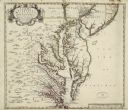
| Description: | Map of Maryland and surrounding states. It shows the boundaries, counties, cities, towns, rivers, and bays. Mountains, forests, and swamps appear pictoria... |

| Date: | 03 1777 |
|---|---|
| Description: | Map showing the British and Hessian attack on Fort Washington in November of 1776. The movements and fortifications of the British and Hessian troops appea... |
If you didn't find the material you searched for, our Library Reference Staff can help.
Call our reference desk at 608-264-6535 or email us at: