 Filter: Categories of Wisconsin Historical Images
Filter: FORMAT_TYPE of prints, fine-art
Filter: Subject of rivers
Filter: Categories of Wisconsin Historical Images
Filter: FORMAT_TYPE of prints, fine-art
Filter: Subject of rivers

| Date: | 01 01 1959 |
|---|---|
| Description: | This map shows many of the rivers, dams, bays, harbors, lakes, and canals. It includes an index of authorized federal project, both for navigation and floo... |

| Date: | 1941 |
|---|---|
| Description: | This map highlights the fishing district and shows labeled rivers, lakes, cities, county boundaries and points of interest. The map includes a list of trai... |

| Date: | 1952 |
|---|---|
| Description: | This map shows lakes, rivers, railroads, highways, roads, hunting grounds and trails around Flambeau Flowage and Boulder Junction in the north, to Brantwoo... |

| Date: | 1952 |
|---|---|
| Description: | This map shows hunting areas, lakes, rivers, railroads, highways, roads, and trails around Clam Lake, Glidden, and Flambeau Flowage in the north, to Hawkin... |

| Date: | 1899 |
|---|---|
| Description: | This map shows color coded and numbered regions of Indian land cessions. Lake Superior and Lake Michigan are labeled and other lakes and rivers are shown. ... |

| Date: | 1899 |
|---|---|
| Description: | This map shows color coded and numbered regions of Indian land cessions. Lake Superior and Lake Michigan are labeled and other lakes and rivers are shown. ... |

| Date: | 1878 |
|---|---|
| Description: | This map shows ward boundaries in red, as well as counties, communities, rivers, lakes, Lake Michigan, and Lake Superior. The bottom left corner includes a... |

| Date: | 1911 |
|---|---|
| Description: | This map shows streets, railroads, the city house numbering system, and the Rock River. The left margin includes a street index. |

| Date: | 1925 |
|---|---|
| Description: | This map oriented with north to the upper right and shows 14 overlapping school districts. From left to right the schools include: Randall, Longfellow, Fra... |

| Date: | 1925 |
|---|---|
| Description: | This map oriented with north to the upper right shows 12 school districts of new proposed schools and existing schools. From left to right existing schools... |

| Date: | 1931 |
|---|---|
| Description: | This map shows heavy industrial districts (yellow), commercial and light manufacturing districts (red), and residential districts (white) as well as a plat... |

| Date: | 1942 |
|---|---|
| Description: | This map shows a paper city laid out in 1836 on the Wisconsin River, now the site of Wyalusing State Park, Grant County. The upper right corner includes a ... |

| Date: | 1855 |
|---|---|
| Description: | This map shows the Fox River, Lake Winnebago, streets, and plats. Below the title reads: "N. F.&Co. will make surveys of lands and plat the same in the bes... |

| Date: | 1889 |
|---|---|
| Description: | This map lists township and section numbers outside municipality, housing additions and subdivisions and plat owners outside municipality, the Black River,... |

| Date: | 1910 |
|---|---|
| Description: | This set of manuscript blueprint maps show block and lot numbers, railroads, and some landownership, including lands and buildings of J.S. Owen Lumber Co. ... |

| Date: | 1900 |
|---|---|
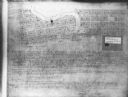
| Description: | This manuscript map shows outline of Fort Winnebago reserve land, Fort Winnebago, claim of A. Grignon, and Indian boundaries. The Fox River and Swan Lake a... |

| Date: | 1917 |
|---|---|
| Description: | This road map shows routes through the state as well as some portions of Iowa, Minnesota, and Michigan. Cities, the Mississippi River, Lake Winnebago, Gree... |

| Date: | 1900 |
|---|---|
| Description: | This map shows a paper city located where "Grass Creek" meets the Pecatonica River, probably in Iowa County. Number lots and streets with dimensions are sh... |
| Date: | 1900 |
|---|---|
| Description: | This map shows plots and streets as well at the Root River. The bottom margin and back of the map include extensive certifications. |

| Date: | 1966 |
|---|---|
| Description: | This map shows trails, roads, creeks, alleged location of George Gardner's trading post, Boulder and Mud Lakes, and a portion of the Wolf River. The map al... |
If you didn't find the material you searched for, our Library Reference Staff can help.
Call our reference desk at 608-264-6535 or email us at: