 Filter: Categories of Wisconsin Historical Images
Filter: COLLECTION_NAME of Map Collection
Filter: Subject of water
Filter: Year of 1800-1899
Filter: Categories of Wisconsin Historical Images
Filter: COLLECTION_NAME of Map Collection
Filter: Subject of water
Filter: Year of 1800-1899

| Date: | 1896 |
|---|---|
| Description: | A portion of John B. Heim's map of the Water Works System of Madison showing the size of the third Wisconsin Capitol (228' x 226') in comparison with the C... |

| Date: | 1886 |
|---|---|
| Description: | Bird's-eye map of Baraboo with inset of Devil's Lake, the south and east sides of the commercial square, the First National Bank, and the Warren House hote... |

| Date: | 1892 |
|---|---|
| Description: | Bird's-eye view of Chicago, with ships in the Lake Michigan harbor. |

| Date: | 1833 |
|---|---|
| Description: | Map of part of the military road from Fort Crawford to Fort Howard. "Recorded on pages 668.669 Book B." Surveyed by Lieut. Center. Scale: 2 miles = 1 inch. |

| Date: | 1831 |
|---|---|
| Description: | Map of the United States "constructed from the latest authorities," including a statistical table. |

| Date: | 1884 |
|---|---|
| Description: | Panorama bird's-eye view of the town of Ashland, on Lake Superior, and the Apostle Islands. |

| Date: | 1892 |
|---|---|
| Description: | Bird's-eye view of the Columbian Exposition pavilions from the vantage point of Lake Michigan. Included is an inset of the Union Passenger Station (now Uni... |

| Date: | 1856 |
|---|---|
| Description: | Wisconsin map illustrating the Mineral Point Railroad and its connections. |

| Date: | 1814 |
|---|---|
| Description: | Map of the Upper Territories of the United States. |

| Date: | 1832 |
|---|---|
| Description: | Route of Military Road from Fort Crawford to Fort Howard. Map shows beginning of route at Fort Crawford. |

| Date: | 1857 |
|---|---|
| Description: | Quarter section of a map of the city of Fond du Lac featuring an illustration of the Lewis House. |

| Date: | 1844 |
|---|---|
| Description: | Map of Wisconsin including Lakes Michigan and Superior. Inset includes "N.W. Part of Wiskonsan." |
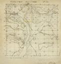
| Date: | 12 01 1851 |
|---|---|
| Description: | Plat map of Wisconsin township 12, North, 9E. |

| Date: | 1879 |
|---|---|
| Description: | Map of Oconto and Marinette counties. |

| Date: | 1856 |
|---|---|
| Description: | Isthmus of Madison, including Lake Mendota, or Great Lake, and Lake Menona [sic]. |

| Date: | 1890 |
|---|---|
| Description: | Portion of a plat map of Madison featuring Lake Mendota. |
If you didn't find the material you searched for, our Library Reference Staff can help.
Call our reference desk at 608-264-6535 or email us at:


