 Filter: Categories of Wisconsin Historical Images
Filter: COLLECTION_NAME of Map Collection
Filter: Subject of men
Filter: Categories of Wisconsin Historical Images
Filter: COLLECTION_NAME of Map Collection
Filter: Subject of men

| Date: | 1857 |
|---|---|
| Description: | Elevated view of Waukesha with two women wearing dresses with a boy in long pants and tam o'shanter hat in foreground against a split-rail fence. Beyond th... |

| Date: | 1870 |
|---|---|
| Description: | Bird's-eye view of Whitewater, with insets. |

| Date: | 1949 |
|---|---|
| Description: | Color bird's-eye map of the University of Wisconsin-Madison as it was midcentury, with two co-eds, several photographs of campus landmarks around edges, an... |

| Date: | 1673 |
|---|---|
| Description: | P. Marquette en Joliet, gedan in't jaar 1673. |
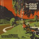
| Date: | 1922 |
|---|---|
| Description: | Front and back cover of the Call of the Open Road, an annual publication of the Milwaukee Journal Tour Department based on its regular columns of mo... |
| Date: | 1878 |
|---|---|
| Description: | Engraving of Ocatagon House, the residence of Mrs. Eliza Richards. Several trees dot the landscape and other buildings can be seen in the distance at right... |

| Date: | 1878 |
|---|---|
| Description: | Illustrated map of Crawford County. On the bottom right is an inset of a group of people near a train on a railroad track. |
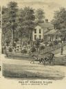
| Date: | 1873 |
|---|---|
| Description: | Engraved view of the home of Francis Dillon. A woman rides on the road in front of the home in a horse-drawn carriage. A woman stands on the porch of the h... |

| Date: | 1930 |
|---|---|
| Description: | Pictorial map of Glacier National Park, Montana and Waterton Lakes National Park, Alberta. Illustrated by Joe Scheurle, it depicts white people, American ... |

| Date: | 1930 |
|---|---|
| Description: | The back of the pictorial map titled Recreational Map of Glacier National Park, Montana: Waterton Lakes National Park, Alberta. 14 panels of text and photo... |

| Date: | 1861 |
|---|---|
| Description: | This map was reproduced photographically and issued in Augusta, Ga., in the early days of the Civil War. It includes panels showing Virginia, Maryland, the... |

| Date: | 1979 |
|---|---|
| Description: | A map of Southern Wisconsin and northern Illinois showing the areas inhabited by the Ho-Chuck, formerly known as the Winnebago. Some of the location names ... |

| Date: | 1936 |
|---|---|
| Description: | This pictorial tourist map from the Wisconsin Conservation Commission depicts vacation activities and identifies tourist destinations throughout the state.... |

| Date: | |
|---|---|
| Description: | This 1907 map of Outagamie County, Wisconsin, shows the township and range grid, towns, sections, cities and villages, railroads, wagon roads, churches, sc... |

| Date: | 1860 |
|---|---|
| Description: | This map of Dodge County, Wisconsin, shows the township and range grid, towns, sections, cities and villages, railroads, roads, property owners and acreage... |

| Date: | 1625 |
|---|---|
| Description: | An illustrated map of the world with captions in Latin. Illustrations include depictions of the seasons and the elements. |

| Date: | 1835 |
|---|---|
| Description: | Shows Walker’s Point, Juneau Town and Kilbourn Town, including labeled buildings, trails and Indian villages. Relief shown by hachures. Oriented with north... |

| Date: | 1874 |
|---|---|
| Description: | Bird's-eye view map of Appleton, Wisconsin. Map reads: "NOTE.-Since the above cut was engraved, the Fox River Pulp & Paper Co.'s Mammoth Mills have been er... |

| Date: | 1995 |
|---|---|
| Description: | This map of La Crosse is a bird’s-eye-view map with relief shown pictorially. The cover lists many points of interests and activities in La Crosse. The cov... |
If you didn't find the material you searched for, our Library Reference Staff can help.
Call our reference desk at 608-264-6535 or email us at:
