 Search: War
Filter: Categories of Wisconsin Historical Images
Filter: Creator Name of United States. Engineer Department.
Filter: Subject of cities and towns
Search: War
Filter: Categories of Wisconsin Historical Images
Filter: Creator Name of United States. Engineer Department.
Filter: Subject of cities and towns
| Date: | 1865 |
|---|---|
| Description: | This map of the battlefield shows U.S. infantry positions in blue, U.S. cavalry positions in yellow, Confederate positions in red, roads, drainage, vegetat... |

| Date: | 1865 |
|---|---|
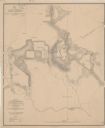
| Description: | This detailed map of the area between Richmond and Petersburg shows fortifications, roads, railroads, towns, street patterns of Petersburg and Richmond, dr... |
| Date: | 1864 |
|---|---|
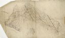
| Description: | This pen and ink tracing illustrates the route traveled by Sherman's troops through Georgia, South Carolina, and North Carolina in the winter and spring of... |

| Date: | 1862 |
|---|---|
| Description: | This detailed map shows batteries and rifle pits, railroads, common and military roads, turnpikes, city streets and names, bridges, ferries, rural houses a... |
| Date: | 1865 |
|---|---|
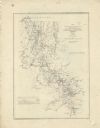
| Description: | This map shows the seven raids made in central Virginia by cavalry under the command of Maj. Gen. Philip H. Sheridan between May 9, 1864, and May 3, 1865. |

| Date: | 1865 |
|---|---|
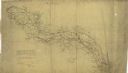
| Description: | This pen and ink map sketches the route taken by General Sherman's troops from Atlanta, Georgia, to Savannah, Georgia. Railroads, rivers, and towns are lab... |

| Date: | 1865 |
|---|---|
| Description: | This map illustrates the lines of defense established by Confederate troops, under the command of General Joseph E. Johnston, at Raleigh, North Carolina, i... |

| Date: | 1867 |
|---|---|
| Description: | This map of the battlefield on the North Anna River at Hanover Junction illustrates the Union positions in blue and Confederate positions in red. Roads, ra... |
| Date: | 1864 |
|---|---|
| Description: | This map depicts the battlefield at Todd's Tavern, Va., the site of a battle on May 7-8, 1864. Depicted are roads, houses, drainage, vegetation and troop p... |
| Date: | 1864 |
|---|---|
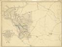
| Description: | This map of northwestern Georgia shows dates and troop positions between Chattanooga, Tennessee, and Jonesboro, Georgia, May-September, 1864. Wisconsin uni... |

| Date: | 1864 |
|---|---|
| Description: | This battlefield map of the Battle of Totopotomoy Creek, also known as the Battle of Bethesda Church, shows the railroads, roads, vegetation and topography... |

| Date: | 1865 |
|---|---|
| Description: | Detailed map of the southeastern United States showing fortifications, "movements of Genl. J.H. Wilson's Cavalry Corps," "pursuit of Hood" and the lines of... |
| Date: | 1864 |
|---|---|
| Description: | Map of northwestern Georgia shows Union and Confederate troop positions between Chattanooga, Tenn., and Jonesboro, Ga., May-Sept., 1864. Wisconsin units in... |

| Date: | 1862 |
|---|---|
| Description: | This map consists of four separate panels. The first illustrates the battlefield at Cedar Mountain on Aug. 9, 1862, where the 3rd Wisconsin Infantry fought... |

| Date: | 1864 |
|---|---|
| Description: | (U.S. 39th Cong. 1stt Sess. Report of Chief engineer) The legend in the upper left corner contains a brief resume of each day's action while the map sho... |

| Date: | |
|---|---|
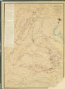
| Description: | This detailed map shows fortifications, headquarters, location and dates of battles, street outline of Atlanta, roads, railroads, vegetation, drainage, rel... |

| Date: | 1863 |
|---|---|
| Description: | These detailed topographical maps of the Battle of Gettysburg show drainage, vegetation, roads, railroads, fences, houses with names of residents, and a de... |

| Date: | 1863 |
|---|---|
| Description: | These detailed topographical maps of the Battle of Gettysburg show drainage, vegetation, roads, railroads, fences, houses with names of residents, and a de... |

| Date: | 1876 |
|---|---|
| Description: | This map of the Battle of Iuka depicts the May 19, 1862, positions of the Union forces in blue and Confederate in red. Indicated on the map are roads, the ... |
If you didn't find the material you searched for, our Library Reference Staff can help.
Call our reference desk at 608-264-6535 or email us at: