 Search: War
Filter: Categories of Wisconsin Historical Images
Filter: Type of Map or Atlas
Search: War
Filter: Categories of Wisconsin Historical Images
Filter: Type of Map or Atlas
| Date: | 1865 |
|---|---|
| Description: | This map shows the seven raids made in central Virginia by cavalry under the command of Maj. Gen. Philip H. Sheridan between May 9, 1864, and May 3, 1865. |

| Date: | |
|---|---|
| Description: | Pen and ink tracing showing the positions of Union and Confederate soldiers, troop camps, location of graves, roads, drainage, vegetation, houses, and fenc... |

| Date: | 1865 |
|---|---|
| Description: | This pen and ink map sketches the route taken by General Sherman's troops from Atlanta, Georgia, to Savannah, Georgia. Railroads, rivers, and towns are lab... |
| Date: | 1949 |
|---|---|
| Description: | This map is comprised of six plates that depict the rout the Sauks and Meskwakis, led by Black Hawk, took through Wisconsin during the Black Hawk War of 18... |

| Date: | 1766 |
|---|---|
| Description: | This map of North America shows the boundaries of European claims at the end of the French and Indian war. The British colonies extend to the Mississippi. ... |

| Date: | 1769 |
|---|---|
| Description: | Map of New Orleans at the start of the French & Indian War, including two inset maps of the Mississippi River Delta and Fort la Balise. It shows streets, r... |
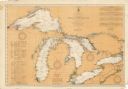
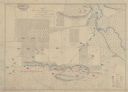
| Date: | 08 30 1911 |
|---|---|
| Description: | Chart showing all of the Great Lakes: Lake Superior, Lake Michigan, Lake Huron, Lake Erie, and Lake Ontario and canals, rivers and cities that border the l... |

| Date: | 1865 |
|---|---|
| Description: | This map shows U.S. cavalry positions in yellow, Confederate infantry positions in blue, and Confederate cavalry positions in red. The map also shows roads... |

| Date: | 1862 |
|---|---|
| Description: | This map of the Battle of Shiloh shows relief by hachures, vegetation, drainage, houses, fields, fences, mills, and roads and is color coded to show the mo... |
| Date: | 1865 |
|---|---|
| Description: | This map traces the route of Union troops under the command of Gen. William S. Smith. This force left Memphis, Tennessee, on February 11, 1864, traveling a... |
| Date: | |
|---|---|
| Description: | Pen and ink tracing by Lt. Napoleon Boardman of the 2nd Wisconsin Cavalry, is colored to show positions of forces and depicts the positions of Union and Co... |

| Date: | 1865 |
|---|---|
| Description: | The map of the battlefield shows entrenchments, villages, roads, the "South Side Rail Road" drainage, vegetation, relief by hachures, houses, and names of ... |

| Date: | 1865 |
|---|---|
| Description: | This map illustrates the lines of defense established by Confederate troops, under the command of General Joseph E. Johnston, at Raleigh, North Carolina, i... |

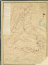
| Date: | 1931 |
|---|---|
| Description: | A topographical map from the U.S. Army Corp of Engineers showing the topography and man-made features in the Camp Williams area of the towns of Orange and ... |

| Date: | 1858 |
|---|---|
| Description: | This map shows the depth of the West Channel and the different types of minerals that make up the floor bed. The steamboat range station is labeled. A note... |

| Date: | 1893 |
|---|---|
| Description: | This map shows the depths of the East Neebish Rapids and the different types of minerals that make up the floor bed. Islands and Canada West is labeled. No... |

| Date: | 04 11 1940 |
|---|---|
| Description: | This blue line print map shows survey monument markers by type and industrial buildings and covers part of the lower Fox River and East River. The map incl... |

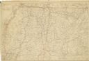
| Date: | 1792 |
|---|---|
| Description: | Map of Pennsylvania showing counties, cities, towns, forges and mills, houses, roads, portages, mountains, lakes, and rivers. The map also shows donation a... |

| Date: | 1862 |
|---|---|
| Description: | This map lists and depicts the positions of "the batteries on Kentucky shore" and the "batteries on Island No. 10." The 8th Wisconsin Infantry and 15th Wis... |

| Date: | 1862 |
|---|---|
| Description: | This map illustrates the official plan for the siege of Yorktown, Virginia, and indicates the headquarters of Generals McClellan, Porter, Woodbury, and Hei... |
If you didn't find the material you searched for, our Library Reference Staff can help.
Call our reference desk at 608-264-6535 or email us at: