 Search: LIGHTHOUSES
Filter: Year of 1800-1899
Filter: Year of 1870-1879
Search: LIGHTHOUSES
Filter: Year of 1800-1899
Filter: Year of 1870-1879

| Date: | 1871 |
|---|---|
| Description: | This map shows railroads, canals, towns and some lighthouses. Areas of the company lands proper, tin, iron, gold & silver, silver islet, and lead are color... |

| Date: | 1871 |
|---|---|
| Description: | Engraved view of Kenosha harbor. A group of men fish from a pier in the foreground while several boats float through the harbor. A tug is pulling a large s... |
| Location: | Green Bay Yacht Club 100 Bay Beach Rd |
|---|---|
| Nearby City: | Green Bay, Brown County |
| Body of water: | Green Bay |
| Location: | Ridges Road |
|---|---|
| Nearby City: | Baileys Harbor, Door County |
| Body of water: | Lake Michigan |
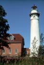
| Community: | La Pointe |
|---|---|
| County: | Ashland |
| Historic Name: | OUTER ISLAND LIGHT |
| Reference Number: | 2487 |
If you didn't find the material you searched for, our Library Reference Staff can help.
Call our reference desk at 608-264-6535 or email us at: