 Filter: Year of 1600-1699

| Date: | 1670 |
|---|---|
| Description: | This map is in French and shows Lac Tracy ov Superieur (Lake Superior), Baye des Puans (Green Bay), and portions of Lac des Ilinois (Lake Michigan) and Lac... |

| Date: | 1673 |
|---|---|
| Description: | P. Marquette en Joliet, gedan in't jaar 1673. |

| Date: | 1673 |
|---|---|
| Description: | Facsimile of the autograph map of the Mississippi or Conception River drawn by Father Marquette at the time of his voyage. From the original preserved at S... |
| Date: | 1610 |
|---|---|
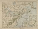
| Description: | A map of New France, including parts of the United States and Canada, to illustrate the Jesuit relations and allied documents. There is some handwriting an... |
| Date: | 1610 |
|---|---|
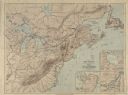
| Description: | A map of New France, including parts of the United States and Canada, to illustrate the Jesuit relations and allied documents. |

| Date: | 1615 |
|---|---|
| Description: | Drawing of Native Americans chasing deer into an enclosure during a hunt. |

| Date: | 1695 |
|---|---|
| Description: | Copperplate engraving; Venice, 1695. Scale [ca. 1:5,069,000] at center. |

| Date: | 1698 |
|---|---|
| Description: | Copperplate engraving. Scale [ca. 1:11,500,00]. |

| Date: | 1688 |
|---|---|
| Description: | This map includes vignettes of Amerindian life with text describing geography, culture, and exploration activity, written in French. The Great Lakes, river... |
| Date: | 1620 |
|---|---|
| Description: | Printed copy of the Mayflower Compact, signed in 1620. Text at the bottom of the document reads: "This paper was made by hand in 1856. A. S. Burbank, Pub... |

| Date: | 1625 |
|---|---|
| Description: | An illustrated map of the world with captions in Latin. Illustrations include depictions of the seasons and the elements. |

| Explorer and Trader |
|---|
| Biography of Daniel Greysolon Sieur Duluth who helped protect the Wisconsin area against raids of the Iroquois. |
| French Explorer |
|---|
| Biography of French explorer Jean Nicolet, believed to be the first European to see Wisconsin. |
| Fur Trader and Explorer |
|---|
| Brief biography of Médard Chouart des Groseilliers who was a fur trader and explorer. |
| Important events in Wisconsin history, from 1622-1699. |
| French Official, Captain and Fur Trader |
|---|
| Biography of French Official, Captain and Fur Trader Paul Marin. |
| Discover historical details and explore our online collections related to Green Bay, Wisconsin. |
| A Priest Follows Another Priest's 300-Year-Old Path to Death |
|---|
| Learn how Rev. A. A. A. Schmirler traced the path Fr. Rene Menard took in 1661 down northern Wisconsin's rivers to the likely spot of his death. |
If you didn't find the material you searched for, our Library Reference Staff can help.
Call our reference desk at 608-264-6535 or email us at:
