 Filter: Categories of Wisconsin Historical Images
Filter: State of New York
Filter: Subject of transportation, military
Filter: Categories of Wisconsin Historical Images
Filter: State of New York
Filter: Subject of transportation, military
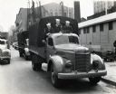
| Date: | 1943 |
|---|---|
| Description: | Three men of the United States Coast Guard ride in the back of an International truck. The photograph was probably taken in front of Camp Chelsea. The orig... |
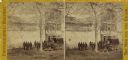
| Date: | |
|---|---|
| Description: | Stereograph of Union infantry standing in front of a slave dealer's shop. |

| Date: | 02 1777 |
|---|---|
| Description: | Map depicting the campaigns of October and November 1776, in Manhattan, Westchester, and part of New Jersey, published only a few months after the conclusi... |

| Date: | 11 1781 |
|---|---|
| Description: | Map of New York, Staten Island, and Long Island, showing the placements of forts, and the movement of troops in 1776. The map also includes towns, cities, ... |
If you didn't find the material you searched for, our Library Reference Staff can help.
Call our reference desk at 608-264-6535 or email us at: