Filter: Categories of Wisconsin Historical Images
Filter: GENRE of Map or Atlas
Filter: Year of 1900-1999
Filter: Year of 1920-1929
Filter: Categories of Wisconsin Historical Images
Filter: GENRE of Map or Atlas
Filter: Year of 1900-1999
Filter: Year of 1920-1929

| Date: | 1926 |
|---|---|
| Description: | Pages 21 and 22 from the 1926 schedule are a map showing the routes of the Goodrich Transit Company, Great Lakes Transit Company, Detroit and Cleveland Lin... |

| Date: | 1926 |
|---|---|
| Description: | Map of the routes of the screw-driven passenger/freight vessels of the Michigan Transit Company for 1926. |

| Date: | 1923 |
|---|---|
| Description: | Map of Oneida County-Rhinelander Airport which was laid out at the county fairgrounds. The map appears on the reverse side of a letter Roy Larson received ... |

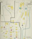
| Date: | 1927 |
|---|---|
| Description: | Color map, hand-drawn with comic figures engaged in various activities throughout map. Bordered by the river on the left and Lake Michigan on the right, in... |

| Date: | 1929 |
|---|---|
| Description: | Bird's-eye map of the University of Wisconsin-Madison on Lake Mendota. Black and white drawing with named streets and numbered buildings without location ... |
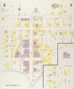
| Date: | 07 1924 |
|---|---|
| Description: | Page 3 of Sanborn-Perris map of Pewaukee. |

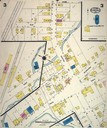
| Date: | 05 1926 |
|---|---|
| Description: | Section 1 of a Sanborn map of Osceola. |

| Date: | 05 1926 |
|---|---|
| Description: | Section 2 of a Sanborn map of Osceola. |
| Date: | 05 1926 |
|---|---|
| Description: | Section 3 of a Sanborn map of Osceola. |

| Date: | 1920 |
|---|---|
| Description: | A map of Madison and the vicinity. Red lines show the street railway. |

| Date: | 1920 |
|---|---|
| Description: | Map of the Nakoma neighborhood including the proposed golf grounds. |

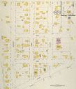
| Date: | 07 1929 |
|---|---|
| Description: | Sheet 10 of a Sanborn map of a portion of Mineral Point. |
| Date: | 07 1929 |
|---|---|
| Description: | Sheet 9 of a Sanborn map of a portion of Mineral Point. |

| Date: | 1925 |
|---|---|
| Description: | A map of the farm planned by Edwin Bottomley in 1844. |

| Date: | 1925 |
|---|---|
| Description: | Sketch of the first floor plan of the house of Mr. Edwin Bottomley. |

| Date: | 1923 |
|---|---|
| Description: | Vilas County. Published by Chicago, Milwaukee, and St. Paul Ry. |

| Date: | 1922 |
|---|---|
| Description: | Wisconsin Geological and Natural History Survey soil map of Wisconsin supplemented by promotional materials about the County's prospects, schools and agric... |

| Date: | 08 1927 |
|---|---|
| Description: | Sanborn map of Ellsworth, Wisconsin. |
If you didn't find the material you searched for, our Library Reference Staff can help.
Call our reference desk at 608-264-6535 or email us at: