 Filter: Categories of Wisconsin Historical Images
Filter: Subject of Voyages and travels
Filter: Year of 1700-1799
Filter: Categories of Wisconsin Historical Images
Filter: Subject of Voyages and travels
Filter: Year of 1700-1799
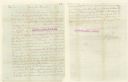
| Date: | 1783 |
|---|---|
| Description: | Letter from Thomas Jefferson to George Rogers Clark suggesting a transcontinental expedition. |

| Date: | 1775 |
|---|---|
| Description: | This map shows the northern Pacific Ocean along with north eastern Asia and western North America. The interior of Asia contains detailed engravings of pla... |

| Date: | 1790 |
|---|---|
| Description: | An updated and corrected version of Robert de Vaugondy's 1750 map "Amérique Septentrionale: Dressée sur les Relations les Plus Modernes des Voyageurs et Na... |

| Date: | 1788 |
|---|---|
| Description: | This map shows the north western coast of North America, including the southern coast of what will be Alaska and parts of the Aleutian Islands. It includes... |

| Date: | 1769 |
|---|---|
| Description: | Double hemispherical map showing the continents, islands, countries, and a few major cities of the world. The routes of a few explorers are depicted and la... |

| Date: | 1724 |
|---|---|
| Description: | Map showing the mountains, rivers, lakes, settlements, islands, and regions of North and South America. Characteristic of de L'Isle, this map is highly det... |

| Date: | 1713 |
|---|---|
| Description: | Map showing the regions explored by Robert de La Salle between 1681 and 1686, as well as the route La Salle, and later Henri Joutel, took, moving north fro... |

| Date: | 1775 |
|---|---|
| Description: | This six sheet large format map is one of the most informative maps of its time. It shows cities, Native American land, lakes, rivers, mountains, topograph... |

| Date: | 1777 |
|---|---|
| Description: | This important map highlights the frantic desire and search for the north west passage. It shows a few settlements and mountains in Russia, north west Amer... |
If you didn't find the material you searched for, our Library Reference Staff can help.
Call our reference desk at 608-264-6535 or email us at: