 Filter: Categories of Wisconsin Historical Images
Filter: Subject of Trails
Filter: County of Bayfield
Filter: Categories of Wisconsin Historical Images
Filter: Subject of Trails
Filter: County of Bayfield
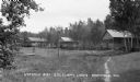
| Date: | 1938 |
|---|---|
| Description: | Cabins around clearing in the woods at Lyndale Bay Resort on Upper Eau Claire Lake. |

| Date: | 1937 |
|---|---|
| Description: | House, garage, and cottage on shoreline of Diamond Lake. |
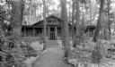
| Date: | 1937 |
|---|---|
| Description: | Stone-lined path through woods leading to a one-story log cabin with a wrap-around porch and window boxes with flowers. The cabin is located near Cable. |
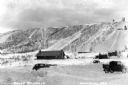
| Date: | 1935 |
|---|---|
| Description: | View of Mount Valhalla during the winter near Washburn. There is a building and a few automobiles parked at the bottom of a large hill covered in snow. The... |

| Date: | 1968 |
|---|---|
| Description: | The map shows fire towers, public camp grounds, roads, snow mobile & riding trails, trout lakes, foot trails, railroads, and National Forest boundaries. |

| Date: | |
|---|---|
| Description: | View of a trail through the forest on land owned by Nature Lovers Paradise resort on Jackson Lake. The text describing the photograph says, "The trail lead... |

| Date: | 1952 |
|---|---|
| Description: | This 1952 map of the northern parts of Bayfield and Douglas counties, Wisconsin, shows points established by E.T. Sweet in 1877, road points confirmed by S... |

| Date: | 1952 |
|---|---|
| Description: | This map of the northern parts of the Chequamegon Bay area in Bayfield and Ashland counties, Wisconsin, shows trails, roads, railroads, stations, the towns... |

| Date: | 1935 |
|---|---|
| Description: | This topographical map of the forest preserve shows highways, roads, trails, telephone lines, Native American reservations, Ranger sub-stations, state nurs... |

| Date: | 1990 |
|---|---|
| Description: | This map shows various types of trails, boat landings, canoe areas, public beaches, picnic areas, campgrounds, golf courses, public tennis courts, and othe... |

| Date: | 2000 |
|---|---|
| Description: | Looking downhill on flagstone and wood plank path edged by giant birch trees, as well as grasses and evergreens. |

| Date: | 1926 |
|---|---|
| Description: | Boardwalk leading to wood steps lined with young birch trees that leads uphill to the main lodge side door. Grasses, shrubs and evergreen trees grow on eit... |
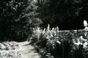
| Date: | 1954 |
|---|---|
| Description: | Tall flowers, possibly delphiniums and hollyhocks, grow between a stone wall and a grass path. A vegetable garden grows on the other side of the path, and ... |

| Date: | 1993 |
|---|---|
| Description: | A path winds through dense ground cover and under tall evergreen trees past the guest house towards the maid's quarters and the main lodge. The guest house... |
If you didn't find the material you searched for, our Library Reference Staff can help.
Call our reference desk at 608-264-6535 or email us at: