 Filter: Categories of Wisconsin Historical Images
Filter: Subject of Superior, Lake
Filter: Subject of michigan, lake
Filter: Year of 1900-1999
Filter: Creator Name of Unknown
Filter: Categories of Wisconsin Historical Images
Filter: Subject of Superior, Lake
Filter: Subject of michigan, lake
Filter: Year of 1900-1999
Filter: Creator Name of Unknown

| Date: | 1941 |
|---|---|
| Description: | Official highway map of Wisconsin, "the playground of the Midwest," showing the state transportation network prior to World War II. |

| Date: | 1900 |
|---|---|
| Description: | A map of Wisconsin, eastern Minnesota and Iowa, northern Iowa, and Michigan’s Upper Peninsula, showing railway lines, with those marked with heavy red line... |

| Date: | 1902 |
|---|---|
| Description: | This map includes six diagrams of the Great Lakes Region comparing advantages of geographical positions and strategic considerations. Portions of Iowa, Ill... |

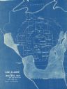
| Date: | 10 15 1956 |
|---|---|
| Description: | This map shows cities with improved harbors along the Great Lakes. A portion of Illinois, Michigan, Ohio, Ontario, and Quebec are also shown. A legend and... |
| Date: | 1928 |
|---|---|
| Description: | This blue line map shows the number of carload shipments to northern and central counties, with Mosinee being the central distribution point. Lake Michigan... |

| Date: | 1922 |
|---|---|
| Description: | This map shows public libraries, state traveling libraries, and county traveling libraries. County boundaries are labeled. Lake Michigan is on the far righ... |

| Date: | 1930 |
|---|---|
| Description: | This map shows surface types on the highways including: concrete, bit, mat, gravels, shales, and unsurfaced. County boundaries, cities, rivers, roads, high... |

| Date: | 1910 |
|---|---|
| Description: | This map shows the Soo Line railroad and Arpin Hardwood Lumber Company lands in red. The top margin of the map reads: "Wisconsin, the safest state in the U... |
If you didn't find the material you searched for, our Library Reference Staff can help.
Call our reference desk at 608-264-6535 or email us at:
