 Filter: Categories of Wisconsin Historical Images
Filter: Subject of Superior, Lake
Filter: Subject of michigan, lake
Filter: Subject of human settlements
Filter: Categories of Wisconsin Historical Images
Filter: Subject of Superior, Lake
Filter: Subject of michigan, lake
Filter: Subject of human settlements

| Date: | 1921 |
|---|---|
| Description: | This map shows counties, roads, Lake Superior, Lake Michigan, and portions of surrounding states. Included is an index to cities, villages and other places... |
| Date: | 1881 |
|---|---|
| Description: | This map shows railroads by operator and projected railroads. Eastern Minnesota, the upper peninsula of Michigan, northeastern Iowa, and northern Illinois ... |

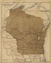
| Date: | 1910 |
|---|---|
| Description: | This map shows counties, roads, Lake Superior, Lake Michigan, and portions of surrounding states. Included is a table of interstate and intrastate railroa... |

| Date: | 1848 |
|---|---|
| Description: | This map shows lighthouses on part of Lake Superior, Green Bay, Lake Michigan, Lake Huron, Lake St. Clair, Lake Erie, Lake Ontario, the St. Lawrence River,... |

| Date: | 1923 |
|---|---|
| Description: | This map includes an explanation that reads: "This chart shows the movement of barley on the Great Lakes, St. Lawrence River, and New York State Barge Cana... |

| Date: | 1923 |
|---|---|
| Description: | This map includes an explanation that reads: "This chart shows the movement of grain on the Great Lakes, St. Lawrence River, and New York State Barge Canal... |

| Date: | 1923 |
|---|---|
| Description: | This map shows the movement of iron ore in parts of Minnesota, Wisconsin, and the Upper Peninsula of Michigan, and includes parts of Lake Superior, Green B... |

| Date: | 1923 |
|---|---|
| Description: | This map shows the movement of iron ore along the Great Lakes. Portions of Minnesota, Iowa, Wisconsin, Illinois, Indiana, Ohio, Michigan, New York, Vermont... |

| Date: | 1923 |
|---|---|
| Description: | This map includes an explanation that reads: "This chart shows the movement of oats on the Great Lakes, St. Lawrence River, and New York State Barge Canal ... |

| Date: | 1923 |
|---|---|
| Description: | This map includes an explanation that reads: "This chart shows the movement of rye on the Great Lakes, St. Lawrence River, and New York State Barge Canal d... |

| Date: | 1923 |
|---|---|
| Description: | This map shows portions of Minnesota, Iowa, Wisconsin, Illinois, Indiana, Ohio, Michigan, New York, Vermont, Massachusetts, Connecticut, Ontario, and Quebe... |

| Date: | 10 15 1956 |
|---|---|
| Description: | This map shows cities with improved harbors along the Great Lakes. A portion of Illinois, Michigan, Ohio, Ontario, and Quebec are also shown. A legend and... |

| Date: | 1926 |
|---|---|
| Description: | This brochure was intended for tourists and shows resorts, lakes and railroads in northwestern Wisconsin and part of Michigan’s upper peninsula. Also inclu... |

| Date: | 1939 |
|---|---|
| Description: | This brochure was intended for tourists and shows resorts, lakes and railroads in northwestern Wisconsin and part of Michigan’s upper peninsula. Also inclu... |

| Date: | 1876 |
|---|---|
| Description: | This map shows eastern Wisconsin, Lake Michigan, western Michigan, northeastern Illinois, and the southern part of Lake Superior. A note is included that r... |

| Date: | 1871 |
|---|---|
| Description: | This map shows railroads, canals, towns and some lighthouses. Areas of the company lands proper, tin, iron, gold & silver, silver islet, and lead are color... |

| Date: | 1890 |
|---|---|
| Description: | This map shows railroad routes, rivers, and lakes throughout the north central states, primarily North and South Dakota, Minnesota, Wisconsin, Illinois, Io... |

| Date: | 1846 |
|---|---|
| Description: | This map shows rivers, lakes, and towns in states west of the Mississippi River. Lake Michigan, Lake Superior, and Green Bay are labeled. Some areas are ou... |
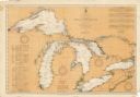
| Date: | 08 30 1911 |
|---|---|
| Description: | Chart showing all of the Great Lakes: Lake Superior, Lake Michigan, Lake Huron, Lake Erie, and Lake Ontario and canals, rivers and cities that border the l... |

| Date: | 1996 |
|---|---|
| Description: | This map shows roads, lakes, points of interest including colleges, trails, historic communities and sites, museums, and parks. Also included are descripti... |
If you didn't find the material you searched for, our Library Reference Staff can help.
Call our reference desk at 608-264-6535 or email us at: