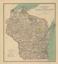
| Date: | 1931 |
|---|---|
| Description: | This U.S. Geological Survey map of Wisconsin shows counties, cities and villages, lighthouses, Indian reservations, military reservations, and bird and gam... |

| Date: | 1936 |
|---|---|
| Description: | This pictorial tourist map from the Wisconsin Conservation Commission depicts vacation activities and identifies tourist destinations throughout the state.... |
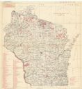
| Date: | 1937 |
|---|---|
| Description: | This Wisconsin Conservation Department map shows the locations of game refuges, fish hatcheries, canning factories, fish camps, and fish refuges in the sta... |
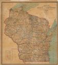
| Date: | 1912 |
|---|---|
| Description: | This map from the U.S. General Land Office shows railroads, counties, cities and villages, rivers, lakes, U.S. Land Offices, Indian reservations, military ... |
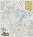
| Date: | 1975 |
|---|---|
| Description: | This map provides an index of outdated quadrangle maps for the state. Communities, counties, rivers, and lakes are labeled including Lake Michigan and Lake... |

| Date: | 1718 |
|---|---|
| Description: | This map shows the Mississippi River, with latitude and longitude coordinates, ad covers east to Lake Ontario and south to Illinois. The inset map (the top... |
| Date: | 1719 |
|---|---|
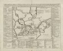
| Description: | Map of the Great Lakes and the St. Lawrence river showing French and English cities and villages, trading posts, Indian villages and tribes, portages, for... |
| Date: | 1783 |
|---|---|
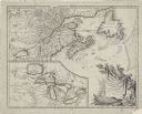
| Description: | Map of eastern Canada and part of America, with an inset map of the Great Lakes region in the lower left corner. It shows boundaries, cities, settlements, ... |
If you didn't find the material you searched for, our Library Reference Staff can help.
Call our reference desk at 608-264-6535 or email us at: