
| Date: | 1887 |
|---|---|
| Description: | Benedict & Co. engineers. As shown by development to March 1st 1887. Inset: Map of northern Wisconsin showing location of range. Lands in red. |

| Date: | 1968 |
|---|---|
| Description: | This map shows lakes, rivers and soil types. Lake Michigan, Lake Superior, and portions of Illinois, Iowa, Michigan, and Minnesota are labeled. A legend to... |
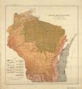
| Date: | 1928 |
|---|---|
| Description: | This map shows geological formations throughout Wisconsin. Lakes and rivers are labeled, including The Mississippi River, Lake Superior, and Lake Michigan.... |
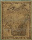
| Date: | 1855 |
|---|---|
| Description: | This map shows counties, cities, rivers, canals, lakes, railroads, common roads, county towns, townships, villages, and post offices. The map includes part... |
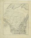
| Date: | 1864 |
|---|---|
| Description: | A geological map of Wisconsin that shows the locations of different rock deposits such as limestone, sandstone, shale, plutonic and the Penokee Iron Range.... |

| Date: | 1882 |
|---|---|
| Description: | A geological map of northern Wisconsin showing the locations of different soil types in the state such as sandy soil, sandy loam, prairie loam, clayey loam... |

| Date: | 1874 |
|---|---|
| Description: | This map of Wisconsin shows cities, counties, railroads already completed and railroads projected, and geological makeup of the land such as lakes. |

| Date: | 1869 |
|---|---|
| Description: | This geological map shows the township grid, counties, cities and villages, rivers, lakes, railroads, and roads. Barron County is still labeled Dallas Coun... |

| Date: | |
|---|---|
| Description: | A hand-drawn Geological map of the Upper Peninsula of Michigan, showing the counties and streams of that area. The map also identifies the location of the... |

| Date: | 1911 |
|---|---|
| Description: | This map, taken from the 1911 Map of Wisconsin showing geology and roads by Hotchkiss and Thwaites, shows the northwest portion of Douglas County, Wisconsi... |

| Date: | 1911 |
|---|---|
| Description: | This 1911 map of the geology of northern Wisconsin between Superior and Hurley was published by the Wisconsin Geological and Natural History Survey in Fred... |
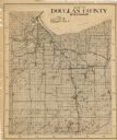
| Date: | 1930 |
|---|---|
| Description: | Shows county system of roads which are surfaced, well graded, common, or unimproved, town roads, state trunk highways, town and village boundaries, schools... |
| Date: | 1915 |
|---|---|
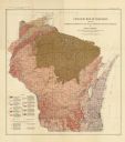
| Description: | This map shows the extent of Wisconsin and pre-Wisconsin drift. The bottom left of the map includes a map categorizing the colors used into geologic period... |

| Date: | 1847 |
|---|---|
| Description: | This map identifies surveyed areas of the Upper Peninsula and shows lakes, rivers, and islands in portions of Wisconsin, Minnesota, Michigan, and upper Can... |

| Date: | 1994 |
|---|---|
| Description: | This map is divided and color coded by forest type. Portions of Michigan, Minnesota, Lake Michigan and Lake Superior are labeled. The reverse includes a sm... |

| Date: | 1920 |
|---|---|
| Description: | This blueprint map covers the boundary area between Lake Superior and the Lac Vieux Desert. The map reads: "Land lines, streams, lakes, railroads, cities a... |

| Date: | |
|---|---|
| Description: | A map of the Apostle Islands, including the harbor of Bayfield and its surroundings. |
If you didn't find the material you searched for, our Library Reference Staff can help.
Call our reference desk at 608-264-6535 or email us at: