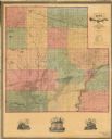
| Date: | 1878 |
|---|---|
| Description: | This 1878 map of Wood County, Wisconsin, shows the township and range grid, towns, sections, cities, villages and post offices, landownership, roads, railr... |

| Date: | 1910 |
|---|---|
| Description: | This early 20th century map of Wood County, Wisconsin, shows the township and range grid, towns, sections, cities and villages, roads and railroads, and st... |

| Date: | 06 22 1891 |
|---|---|
| Description: | This 1891 manuscript map depicts Cranberry Creek and wetlands in part of the Town of Port Edwards, Wood County, Wisconsin. Elevations and falls in the cree... |

| Date: | 1992 |
|---|---|
| Description: | This 1992 map of Wood County, Wisconsin, shows towns, sections, cities and villages, highways and roads, railroads, and lakes and streams. An inset map of ... |

| Date: | 04 28 1936 |
|---|---|
| Description: | A view looking downstream at a recently built concrete dam with four gates. A note on the reverse of the photograph reads: "Dam built by WPA in drainage di... |
If you didn't find the material you searched for, our Library Reference Staff can help.
Call our reference desk at 608-264-6535 or email us at: