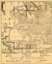
| Date: | 1947 |
|---|---|
| Description: | This map of Wauwatosa shows 10 zoning class types of land including residential, manufacturing, and business. The map also shows government buildings, some... |

| Date: | 1939 |
|---|---|
| Description: | This is a zoning map of Wauwatosa with a key of districts including agricultural, resident, business, commercial, and industrial. The map features labeled ... |

| Date: | 1965 |
|---|---|
| Description: | This map shows 32 zoning districts, house numbering system, parks, cemeteries, and Milwaukee County institutional buildings. |

| Date: | 1968 |
|---|---|
| Description: | A towering specimen of Ulmus americana standing along the river in the Menomonee River Parkway. There are large blocks of ice on the shore. This tre... |

| Date: | 11 05 1913 |
|---|---|
| Description: | Text on the front reads: "The Menominee, Wauwatosa, Wis." The Menominee River flowing through a park-like area. The right bank appears eroded, the left ban... |
If you didn't find the material you searched for, our Library Reference Staff can help.
Call our reference desk at 608-264-6535 or email us at: