Filter: Categories of Wisconsin Historical Images
Filter: Subject of Rivers
Filter: County of Dane
Filter: Categories of Wisconsin Historical Images
Filter: Subject of Rivers
Filter: County of Dane
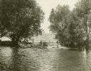
| Date: | 10 13 1927 |
|---|---|
| Description: | Scenic view of outlet of Lake Mendota near Tenney Park and Yahara River. |
| Date: | 10 15 1927 |
|---|---|
| Description: | Scenic view of outlet of Lake Mendota near Tenney Park and Yahara River. |
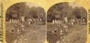
| Date: | 1873 |
|---|---|
| Description: | Identified as " Lover's Retreat, Spring View." Group in field with stream on a picnic. Children are stepping on stones in foreground with U.S. flag, people... |
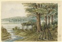
| Date: | 1858 |
|---|---|
| Description: | Hölzlhuber's first extensive excursion in Wisconsin was a walking tour from Madison to Prairie du Sac along the Wisconsin River. He lost his way along Lake... |

| Date: | 1956 |
|---|---|
| Description: | Aerial view looking northeast from a point over the east end of Middleton, showing the west end of Lake Mendota (right mid-ground). Fox Bluff juts into the... |

| Date: | 1911 |
|---|---|
| Description: | Plat Map of Blooming Grove in "Atlas of Dane County, Wisconsin." |
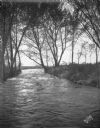
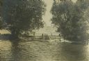
| Date: | |
|---|---|
| Description: | A man stands, with a rowboat in the background, at the mouth of the Yahara river on the dam at Lake Mendota. |
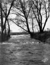
| Date: | |
|---|---|
| Description: | The Spillway on Lake Mendota (Tenney Park) and the Yahara River. |
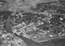
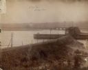
| Date: | 11 1928 |
|---|---|
| Description: | Aerial view of Stoughton including the central business district, the Yahara River, and the surrounding countryside. |

| Date: | 11 1928 |
|---|---|
| Description: | Aerial view of Stoughton, including the central business district, residential areas, the Yahara River, and the surrounding countryside. |

| Date: | 1930 |
|---|---|
| Description: | Aerial view of Tenney Park, including the lagoon, residences surrounding the park, and the shoreline of Lake Mendota on bottom left. |
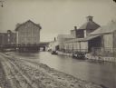
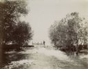
| Date: | |
|---|---|
| Description: | Farwell's Mill on the Yahara River at Lake Mendota. |

| Date: | 1853 |
|---|---|
| Description: | Farwell's Mill on the Yahara River at Lake Mendota. |

| Date: | 1907 |
|---|---|
| Description: | The Yahara River Parkway, with the old Lapham School at 1436 East Dayton Street at North Thornton visible on the righthand side. |
If you didn't find the material you searched for, our Library Reference Staff can help.
Call our reference desk at 608-264-6535 or email us at: